|
|
|
|
|
|
|
|
|
|
|
|
|
|
|
|
|
Oceans - World
|
|
|
|
|
1611.
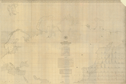
Maury's wind and current charts. 3rd ed. 1849. No. 2. Series A. N.p.: 1849-1860.
Cartographer:
M. F. Maury.
|
1849-1860. |
Size: Ca. 40 x 26 cm.
|
(551:47: m44 Oversize vertical and horizontal) |
|
1612.
Mean barometrical pressure for the year; and Range of mean barometrical pressure for the year. London: [1899?].
|
[1889?]. |
Size of paper: 66.6 x 49.8 cm.
|
(980: [1889?]: M568mbp Large) |
|
This is "Supplement to charts showing the mean barometrical pressure over the Atlantic, Indian and Pacific Oceans. (Official
No. 76.) Issued by the authority of the Meteorological Council."
|
|
|
1613.
Carte générale bathymétrique des océans dressée par ordre de S.A.S. le Prince de Monaco d'après le mémoire de M. le Professeur
Thoulet. . . sous le direction de M. Charles Sauerwein, enseigne de vaisseau. Par M. Tollemer. Paris: Erhard Frères: [ca.
1910-1920]. 25 maps and title page.
Cartographer:
Thoulet, Charles Sauerwein, Tollemer, Battaille, Bolzé, Lebas, Lévéque, Morell, and Normand.
Engraver:
Erhard Frères.
|
[ca. 1910-1920]. |
Scale: 1:10,000,000.
Size: Various.
Colored.
|
(900: [ca. 1910-1920] :T393gmo Large) |
|
1614.
Carte générale bathymétrique des océans. Bureau Hydrographique International, Monaco. Monaco: 1935.
|
1935. |
4 sections.
Size: 58.5 x 100 cm.
|
(900: 1935: M745hyd Roller) |
|
"La lère et la 2ème édition ont été publiées par ordre de S.A.S. le prince Albert ler de Monaco."
|
|
|
1615.
U.S. Hydrographic Office. Pilot charts. Washington: various dates.
|
v.d. |
|
(900: Un3p Extra-oversize) |
|
Pacific Ocean
|
|
|
|
|
1616.
A chart shewing the tract of Capt. Cook's last voyage. 1799.
|
1799. |
Scale: (2.5 cm. = ca. 19° latitude).
Size: 20.4 x 25.7 cm.
|
(910: P29) |
|
In: John Payne, A new and complete system of universal geography, vol. 4, opposite p. 521.
Wheat: 914
|
|
|
1617.
The voyages of Captain Cook. London: A. & C. Black: 1934.
Engraver:
Emery Walker, Ltd.
|
1934. |
Size: 35.5 x 55.7 cm.
|
(910: 1934: B351vcc Small) |
|
Photostat, taken from Exploration of the Pacific, by J. C. Beaglehole [London: A. C. Black: 1934].
Provenance:
Presented by Thomas D. Cope, 9 December 1949.
|
|
|
1618.
Maury's wind and current chart. Whale sheet No. 2. Series F. U.S. Hydrographical Office. N.p.: n.d.
Cartographer:
M. F. Maury.
|
n.d. |
Size: 59.8 x 90.6 cm.
Colored.
|
(900: n.d.: M444wcc Small) |
|
Contains part of the book plate of J. Peter Lesley.
|
|
|
Polynesia
|
|
|
|
|
1619.
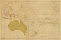
Carte de la Polynesie ou la cinquième partie de la terre [title also in Swedish]. Par Daniel Djurberg. Stockholm: 1780.
Cartographer:
Daniel Djurberg.
|
1780. |
Size: 47.5 x 71.8 cm.
Colored.
|
(940: 1780: D642ppt Large) |
|
Inset: Easter and S. Daniel Islands.
Shows tracks of Captain Cook, de Surville, Tasman, Roggewin, Wallis, Bougainville, Biron, Mendonna, Mendarina, La Maire, and
Carteret.
|
|
|
1620.
Keeling Islands. H.M.S. Beagle. London: Henry Colburn: 1839.
Engraver:
J. & C. Walker.
|
1839. |
Size: 31.5 x 46.6 cm.
|
(995.3: 1839: K257son Small) |
|
Insets: South Keeling Islands; North Keeling Islands.
Removed from Narrative of the surveying voyages of His Majesty's Ships Adventure and Beagle . . . London: 1839.
|
|
|
Atlantic Ocean
|
|
|
|
|
1621.
The present state of Europe & America or the Man in the Moon taking a view of the English Armade. [1771].
|
[1771]. |
Size: 6.1 x 10.5 cm.
|
(973.3: P71) |
|
In: The plea of the colonies on the charges brought against them by Lord Mansfield . . . [1771].
Wheat: 2 [or 3]
Provenance:
One copy was presented by the Estate of Richard Gimbel, 1974.
|
|
|
1622.
Remarques sur la navigation de Terre-Neuve à New-York afin d'éviter les Courrants et les bas-fonds au sud de Nantuckett et
du Banc de George. [Franklin's second chart of the Gulf Stream]. Paris: Le Rouge: [ca. 1785].
Cartographer:
Benjamin Franklin.
|
[ca. 1785]. |
Size: 31.7 x 36.2 cm.
|
(980: [ca. 1785]: F843sLn Small) |
|
See: Franklin Bache, "Where is Franklin's first chart of the Gulf Stream?" American Philosophical Society, Proceedings, vol. 76, p. 731, 1936; and Benjamin Franklin, "A letter from Dr. Benjamin Franklin to Mr. Alphonsus Le Roy . . . August
1785," American Philosophical Society, Transactions, vol. 2. Philadelphia: 1786.
|
|
|
1623.
A chart of the Gulf Stream. [1786].
Engraver:
James Poupard.
|
[1786]. |
Scale: [2.5 cm. = ca. 4° latitude].
Size: 20.3 x 25.5 cm.
|
(506:73: Am4) |
|
Inset: [Annual passage of herrings].
In: Benjamin Franklin, "A letter from Benjamin Franklin . . ." with "Remarks upon the Navigation . . ." as an appendix to
Franklin's "A letter . . ." The "Annual passage of herrings" was published for: John Gilpin, "Observations on the annual passage
of herrings." Both articles in: American Philosophical Society. Transactions, vol. 3.
|
|
|
1624.
Chart of the Gulf Stream. [1789].
|
[1789]. |
Size: 18.5 x 21.7 cm.
|
(050: Am33) |
|
In: Benjamin Franklin, "Remarks upon the navigation . . . Gulf Stream," American Museum, vol. 5, opposite p. 213.
Wheat: 723
|
|
|
1625.
[Chart of the North Atlantic Ocean. 1792].
|
[1792]. |
Scale: [2.5 cm. = ca. 4° latitude].
Size: 19.9 x 41.2 cm.
|
(506.73: Am4) |
|
See: Jonathan Williams, Jr., "Memoir on the use of the thermometer in discovering banks, soundings, &c," American Philosophical
Society, Transactions, vol. 3, copy 4, opposite p. 84.
Wheat: 724
Provenance:
Presented by Jonathan Williams, Jr., 20 November 1795.
|
|
|
1626.
[Chart of the North Atlantic Ocean. 1792].
|
[1792]. |
Scale: [2.5 cm. = ca. 4° latitude].
Size: 20.1 x 42.1 cm.
|
(506.73: am4t; Pam., vol. 316, no. 1; and, 656: W67) |
|
See: Jonathan Williams, Jr., "Memoir on the use of the thermometer in discovering banks, soundings, &c," American Philosophical
Society, Transactions, vol. 3, copy 1, opposite p. 84.
Wheat: 725
Provenance:
One copy presented by Jonathan Williams, Jr., 19 November 1799.
|
|
|
1627.
Chart of North Atlantic Ocean with tracks of the shipping to West Indies, North America, etc. [Edinburgh]: 1815.
Engraver:
J. Moffat.
|
1815. |
Size: 50.1 x 63.3 cm.
Colored.
|
(983: 1815: M735cna Small) |
|
Drawn and engraved for Thomson's new general atlas, 1 May 1815.
|
|
|
1628.
America to the British Channel, 1816. Navigation Chart no. 1. [London]: Davis & Dickson: [1816].
Cartographer:
I. Garnett.
Engraver:
H. Frost.
|
[1816]. |
Scale: 1 in. = 300 mi.
Size: 11.2 x 36 cm.
Size of paper: 26.5 x 37.9 cm.
|
(983: [1816]: G163abc Small) |
|
On 20 November 1807, Garnett's nautical chart was ordered to be printed in the Transactions. This chart had been received 16 October 1807 as an essay for the Extra Magellanic Premium and the members "determined by
ballot [it] to be worthy, and awarded $45.00, or a medal of the value thereof" to Garnett. He took the chart and had it published
in New Brunswick, New Jersey, in 1807.
Provenance:
Presented by John Garnett prior to 1818.
|
|
|
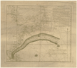
1629.
Chart of Georges Shoal & Bank, surveyed by Charles Wilkes, Lieut. Commandant . . . in U.S. brig Porpoise, schooners Maria and Hadassah . . . Published under the direction of the Navy Commissioners, 1837. N.p.: 1837.
Cartographer:
C. Wilkes, J. A. Alden, and W. May.
Engraver:
S. Stiles, Sherman, Smith.
|
1837. |
Size: 99.1 x 110.8 cm.
|
(983: 1837: Un36gs Small) |
|
Original in U.S. Congress, Collection of maps etc., published by order of Congress, Washington, 1843, no. 110.
Provenance:
Presented by the Athenaeum of Philadelphia, 4 January 1839; and J. Forsyth for Capt. Wilkes, 16 August 1839.
|
|
|
1630.
Wreck chart of the North Atlantic coast of America. U.S. Navy Department. Hydrographic Office. Bureau of Navigation. Richardson Clover, Lt. Commander, U.S. Navy, Hydrographer.
Washington: 1893.
Cartographer:
Richardson Clover.
|
1893. |
Size: 62.1 x 58 cm.
Size of paper: 87 x 61.5 cm.
Colored.
|
(983: 1893: Un36nho Large) |
|
Gives list of wrecks and derelicts, etc., from 1887 to 1891.
|
|
|
1631.
Monthly pilot charts of the North Atlantic and Mediterranean. London: E. Weller & Grahams Ltd. Litho.: 1901-1902.
Engraver:
E. Weller & Grahams Ltd
|
1901-1902. |
16 maps.
Size: 46 x 65.7 cm.
Colored.
|
(983: 1901-1902: M765nam Large) |
|
Charts for January, April-December 1901, and January-May 1902.
|
|
|
1632.
Physiographic diagram Atlantic Ocean (Sheet 1) by Bruce C. Heezen and Marie Tharp. Geological Society of America, Special Paper 65. Reprinted by permission of the Lamont Geological Observatory (Columbia University).
[Washington]: 1957.
Cartographer:
Bruce C. Heezen and Marie Tharp.
|
1957. |
Scale: Vertical exaggeration about 20:1.
Size: 71.7 x 141.2 cm.
Colored.
|
(983: 1957: H363ao Large) |
|
See: Geological Society of America, Special paper , no. 65. New York: Geological Society of America: 1957.
|
|
|
1633.
Physiographic diagram of the South Atlantic Ocean, the Caribbean Sea, the Scotia Sea and the eastern margin of the South Pacific
Ocean. By Bruce C. Heezen and Marie Tharp. Lamont Geological Observatory, Columbia University. Published by the Geological Society of America. Washington: Williams & Heintz Map Corp.: 1961.
Cartographer:
Bruce C. Heezen and Marie Tharp.
|
1961. |
Size: 142.2 x 118.7 cm.
Colored.
|
(987: 1961: G293pdsa Large) |
|
Indian Ocean
|
|
|
|
|
1634.
Indischer Ocean. Commodore B. V. Wüllerstorf-Urbair, S. M. Fregatte Novara. 1857. [Vienna]: K.-K. Hof- u. Staats-Druckerei: [ca. 1860].
Cartographer:
B. V. Wüllerstorf-Urbair.
|
[ca. 1860]. |
7 maps.
Scales: Various.
Size of paper: Ca. 80 x 56.5 cm.
|
(990: [ca. 1860]: W957fno Large) |
|
|
|
|
1635.
Physiographic diagram of the Indian Ocean the Red Sea, the South China Sea, the Sulu Sea and the Celebes Sea by Bruce C. Heezen
and Marie Tharp. Lamont Geological Observatory, Department of Geology, Columbia University. Published by the Geological Society of America.
Washington: Williams & Heintz Map Corp.: 1964.
Cartographer:
Bruce C. Heezen and Marie Tharp.
|
1964. |
Size: 155.5 x 120 cm.
Colored.
|
(990: 1964: G293pdio Large) |
|
Descriptive sheet accompanies physiographic diagram. It has five figures, of which three are maps: 3. Control chart. All sounding
lines used in the preparation; 4. Physiographic provinces; and 5. Bathymetric sketch of the Indian Ocean. Size of these three
maps: ca. 51 x 39 cm.
|
|