|
|
|
|
|
|
|
|
|
|
|
|
|
|
|
|
|
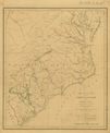
Southern States
|
|
|
|
|
1081.
A general map of the southern British colonies, in America. Comprehending North and South Carolina, Georgia, East and West Florida, with the neighboring Indian countries. From the modern
surveys of Engineer de Brahm, Capt. Collet, Mouzon & others; from the large hydrographical survey of the coasts of East and
West Florida. By B. Romans. 1776. [Title at top of sheet]: The seat of war, in the southern British colonies, comprehending
North and South Carolina, Georgia, East and West Florida, &ca. London: R. Sayer and J. Bennett: 1776 [15 October 1776].
Cartographer:
B. Romans, De Brahm, Capt. Collet, and Mouzon.
|
[15 October 1776]. |
Scale: 1 degree = 69½ British statute mi.
Size: 50 x 64.5 cm.
Colored.
|
(636.5: 1776: R667bcm Large) |
|
Insets: Plan of Charleston; Plan of St. Augustine.
Originally in American military pocket atlas; removed from binding 5 November 1962
|
|
|
1082.
A new map of North & South Carolina, & Georgia.
Engraver:
Aitken.
|
[1776]. |
Scale: 2.5 cm. = 110 mi.
Size: 15.7 x 21.8 cm.
|
(050: P383) |
|
In: Pennsylvania Magazine, vol. 2 (1776), opposite p. 268.
Wheat: 489
|
|
|
1083.
A map of the states of Virginia, North Carolina, South Carolina and Georgia comprehending the Spanish provinces of East and
West Florida exhibiting the boundaries as fixed by the late treaty of peace between the United States and the Spanish dominions
compiled from late surveys and observations. 1788.
Cartographer:
Joseph Purcell.
Engraver:
Amos Doolittle.
|
1788. |
Scale: 2.5 cm. = 95 mi.
Size: 31 x 36.4 cm.
|
(917.3: M83) |
|
In: Jedidiah Morse, American geography, opposite p. l.
Wheat: 491
|
|
|
1084.
New map of the states of Georgia, South and North Carolina, Virginia and Maryland, including the Spanish provinces of West
and East Florida, from the latest surveys. New York: 1789.
Engraver:
C. Tiebout.
|
1789. |
Size: 30.3 x 37 cm.
|
(Paine 68: G65h, and 973.3: G65) |
|
In: William Gordon, History of the rise of the United States. New York: Hodge, Allen and Campbell: 1789, vol. 1, front.
Wheat: 492
Provenance:
Presented by Estate of Richard Gimbel, 1974.
|
|
|
1085.
Map of the southern parts of the United States of America. [1797].
Cartographer:
Abraham Bradley, Jr.
Engraver:
S. Hill.
|
[1797]. |
Scale: 2.5 cm. = 68 mi.
Size: 19.6 x 39.1 cm.
|
(917.3: M83am) |
|
In: Jedidiah Morse, The American gazetteer, opposite "Southern States."
Wheat: 496
|
|
|
1086.
A map of the southern section of the United States including the Floridas & Bahama Islands shewing the seat of war, in that
department. Philadelphia: Melish: 1813.
Cartographer:
John Melish.
Engraver:
H. S. Tanner.
|
1813. |
Scale: 1 in. = 60 mi.
Size: 40.7 x 52.8 cm.
Colored.
|
(636.5: 1813: M485fb Small) |
|
Originally in: John Melish, Military and topographical atlas. Philadelphia: Palmer: 1813, no. 5.
|
|
|
1087.
A map of the southern section of the United States including the Floridas & Bahama Islands, shewing the seat of war, in that
department. Philadelphia: John Melish: 1813 [March 1813].
Cartographer:
John Melish.
Engraver:
H. S. Tanner.
|
1813. |
Size: 40.5 x 52.3 cm.
Colored.
|
(650: 1813: M485fbi Small) |
|
1088.
Southern provinces of the United States. No. 57. [London: 1817].
Engraver:
Hewitt.
|
[1817]. |
Scale: 1 in. = 47 British statute mi.
Size: 49.6 x 59.2 cm.
Colored.
|
(636.5: [1817]: H493sps Large) |
|
Inset: Characteristic scenery of the Hudson River.
Drawn and engraved for Thompson's New general atlas, 1817.
|
|
|
1089.
The seat of war of the revolution in the southern states; shewing the principal movements of the hostile armies. Philadelphia: [1822].
Cartographer:
H. S. Tanner.
Engraver:
H. S. Tanner.
|
[1822]. |
Scale: 1 in. = 30 mi.
Size: 45 x 38.4 cm.
Colored..
|
(650: [1822]: T158swr Small) |
|
See: William Johnson, Sketches of the life and correspondence of Major General Greene. Charleston: Miller:1822.
|
|
|
1090.
Map of reconnaissance exhibiting the country between Washington and New Orleans with the routes examined in reference to a
contemplated national road between these two cities. U.S. War Department. N.p.: [1826].
|
[1826]. |
Scale: 1 in. = 10 mi.
Size: 50.6 x 69.3 cm.
Colored.
|
(636.5: [1826]: Un38wno Large) |
|
To accompany Document No. 156. 19th Congress. 1st Session. House of Representatives. Road from Washington to New Orleans. Washington: 1826. Compiled from Tanner's atlas.
|
|
|
1091.
Military map showing the marches of the United States forces under command of Maj. Gen. W. T. Sherman U.S.A. during the years 1863, 1864, 1865 . . . Drawn by Capt. William Kosak . . . and John B. Muller.
U.S. Army. Corps of Topographical Engineers. St. Louis, Mo.: 1865
Cartographer:
William Kosak and John B. Muller.
Engraver:
H. C. Evans and F. Courtenay.
|
1865. |
Scale: 1 in. = 25 mi.
Size: 54.5 x 94 cm.
Colored.
|
(636.5: 1865: Un38mfs Large) |
|
1092.
West Indian hurricane of September 1-10, 1900. U.S. Department of Agriculture. Weather Bureau. Storm bulletin no. 1, 1900. Willis L. Moore, chief. Washington: 1900. 6 maps
on one sheet.
Cartographer:
Willis L. Moore.
|
1900. |
Size of sheet: 61 x 48.5 cm.
Colored.
|
(630: 1900: Un38hur Small) |
|
Descriptive matter at bottom of sheet.
|
|
|
1093.
A general map of the southern British colonies, in America. Comprehending North and South Carolina, Georgia, East and West Florida, with the neighbouring Indian countries. From the
modern surveys of . . . de Brahm, Capt. Collet, Mouzon & others; and from the large hydrographical survey of the coasts of
East and West Florida. By B. Romans. 1776. London: R. Sayer and J. Bennett: 1776. Reprinted by U.S. Geological Survey, 1937,
under the title: Georgia at the time of the ratification of the Constitution.
Cartographer:
B. Romans.
|
1937. |
Scale: 1 degree = 69½ British mi.
Size: 43.6 x 55.5 cm.
Colored.
|
(658: 1937: R667cgf Large) |
|
Insets: The settled portion of Georgia (from Abraham Bradley's 1796 map of the United States); the correct southern boundary of
Georgia in 1787.
See: U.S. Geological Survey, Bulletin 817. Washington: 1930.
|
|
|
Virginia
|
|
|
|
|
1094.
A map of the most inhabited part of Virginia, containing the whole province of Maryland, with part of Pensilvania, New Jersey
and North Carolina. Drawn by Joshua Fry and Peter Jefferson in 1775. . . . London: R. Sayer and Thomas Jefferys: 1775.
Cartographer:
Joshua Fry, Peter Jefferson Will[ia]m Byrd, William Dandridge, Richard Fitzwilliams, Alexander Irving, Will[ia]m Mayo, William
Churton, and Daniel Weldon.
|
1775. |
Scale: 1 in. = 10 mi.
Size: 78.3 x 123.3 cm.
Colored.
|
(654: 1755: F943vmc Large) |
|
1095.
Map of the maritime parts of Virginia exhibiting the seat of war, and of Ld. Dunmore's depredations. In that colony. [1776].
Cartographer:
P. S. Du Simitière.
Engraver:
Robert Aitken.
|
[1776]. |
Scale: 2.5 cm. = 10 mi.
Size: 24.9 x 27.6 cm.
|
(654: [1776]: D852mpv Small) |
|
Wheat: 540
Pennsylvania Magazine, vol. 2 (1776), opposite p. 184.
|
|
|
1096.
From Annapolis (70) to Bowling-green Ord[inar]y. [1789, 1961 reprint].
|
[1789]. |
Size: 17.1 x 11.6 cm.
|
(526.8 C68s) |
|
In: Christopher Colles, A survey of the roads.
Wheat: 550
|
|
|
1097.
From Annapolis (66) to Dumfries. [1789, 1961 reprint].
|
[1789]. |
Size: 17.3 x 11.5 cm.
|
(526.8: C68s) |
|
In: Christopher Colles, A survey of the roads.
Wheat: 546
|
|
|
1098.
From Annapolis (67) to Fredericksburg, Va. [1789, 1961 reprint].
|
[1789]. |
Size: 17.2 x 11.5 cm.
|
(526.8 C68s) |
|
In: Christopher Colles, A survey of the roads .
Wheat: 547
|
|
|
1099.
From Annapolis (68) to Fredericksburg. [1789, 1961 reprint].
|
[1789]. |
Size: 17.1 x 11.4 cm.
|
(526.8: C68s) |
|
In: Christopher Colles, A survey of the roads.
Wheat: 548
|
|
|
1100.
From Annapolis (73) to Hanover & Newcastle. [1789, 1961 reprint].
|
[1789]. |
Size: 17.2 x 11.5 cm.
|
(526.8: C68s) |
|
In: Christopher Colles, A survey of the roads.
Wheat: 553
|
|
|
1101.
From Annapolis (72) to Hanover Court-House. [1789, 1961 reprint].
|
[1789]. |
Size: 17.2 x 11.4 cm.
|
(526.8: C68s) |
|
In: Christopher Colles, A survey of the roads.
Wheat: 552
|
|
|
1102.
From Annapolis (71) to Head Lynchs Ord[inar]y. [1789, 1961 reprint].
|
[1789]. |
Size: 17.1 x 11.6 cm.
|
(526.8: C68s) |
|
In: Christopher Colles, A survey of the roads.
Wheat: 551
|
|
|
1103.
From Annapolis (74) to New Kent Court-house. [1789, 1961 reprint].
|
[1789]. |
Size: 17.2 x 11.5 cm.
|
(526.8: C68s) |
|
In: Christopher Colles, A survey of the roads.
Wheat: 554
|
|
|
1104.
From Annapolis (75) to New Kent, Court-house. [1789, 1961 reprint].
|
[1789]. |
Size: 17.2 x 11.6 cm.
|
(526.8: C68s) |
|
In: Christopher Colles, A survey of the roads.
Wheat: 555
|
|
|
1105.
From Annapolis (69) to Todd's Ordinary. [1789, 1961 reprint].
|
[1789]. |
Size: 17.1 x 11.5 cm.
|
(526.8: C68s) |
|
In: Christopher Colles, A survey of the roads.
Wheat: 549
|
|
|
1106.
From Annapolis (76) to Williamsburgh. [1789, 1961 reprint].
|
[1789]. |
Size: 17.1 x 11.5 cm.
|
(526.8: C68s) |
|
In: Christopher Colles, A survey of the roads.
Wheat: 556
|
|
|
1107.
From Annapolis (77) to Williamsburgh. [1789, 1961 reprint].
|
[1789]. |
Size: 17.2 x 11.6 cm.
|
(526.8: C68s) |
|
In: Christopher Colles, A survey of the roads.
Wheat: 557
|
|
|
1108.
From Annapolis (78) to York. [1789, 1961 reprint].
|
[1789]. |
Size: 17.2 x 11.4 cm.
|
(526.8: C68s) |
|
In: Christopher Colles, A survey of the roads.
Wheat: 558
|
|
|
1109.
From Annapolis (79) to York. [1789, 1961 reprint].
|
[1789]. |
Size: 17.2 x 11.5 cm.
|
(526.8: C68s) |
|
In: Christopher Colles, A survey of the roads.
Wheat: 559
|
|
|
1110.
From Williamsburgh (80) to Ayletts Warehouse [1789, 1961 reprint].
|
[1789]. |
Size: 17.1 x 11.7 cm.
|
(526.8: C68s) |
|
In: Christopher Colles, A survey of the roads.
Wheat: 560
|
|
|
1111.
From Williarnsburg (81) to Aylett's Ware-houses. [1789, 1961 reprint].
|
[1789]. |
Size: 17.1 x 11.6 cm.
|
(526.8: C68s) |
|
In: Christopher Colles, A survey of the roads.
Wheat: 561
|
|
|
1112.
From Williamsburg (85) to Hooe's ferry. [1789, 1961 reprint].
|
[1789]. |
Size: 17.2 x 12.1 cm.
|
(526.8: C68s) |
|
In: Christopher Colles, A survey of the roads.
Wheat: 565
|
|
|
1113.
From Williamsburg (86) to Hooe's ferry. [1789, 1961 reprint].
|
[1789]. |
Size: 17.7 x 11.6 cm.
|
(526.8: C68s) |
|
In: Christopher Colles, A survey of the roads.
Wheat: 566
|
|
|
1114.
From Williamsburg (83) to Port-Royal. [1789, 1961 reprint].
|
[1789]. |
Size: 17 x 11.6 cm.
|
(526.8: C68s) |
|
In: Christopher Colles, A survey of the roads.
Wheat: 563
|
|
|
1115.
From Williamsburg (84) to Port-royal. [1789, 1961 reprint].
|
[1789]. |
Size: 17.2 x 11.5 cm.
|
(526.8: C68s) |
|
In: Christopher Colles, A survey of the roads.
Wheat: 564
|
|
|
1116.
From Williamsburg (82) to Sneed's Ordinary. [1789, 1961 reprint].
|
[1789]. |
Size: 17 x 11.7 cm.
|
(526.8: C68s) |
|
In: Christopher Colles, A survey of the roads.
Wheat: 562
|
|
|
1117
Virginia. [1795].
|
[1795]. |
Scale: 2.5 cm. = 68 mi.
Size: 15.3 x 18.5cm.
|
(Paine 68: Sco3u) |
|
In: Joseph Scott, The United States gazetteer, opposite "Virginia."
Wheat: 569
Provenance:
Presented by the Estate of Richard Gimbel, 1974.
|
|
|
1118.
Virginia. [1796].
Engraver:
W. Barker.
|
[1796]. |
Scale: 2.5 cm. = 65 mi.
Size: 14.7 x 19.1 cm.
|
(917.3: C25c) |
|
In: Mathew Carey, Carey's American pocket atlas, opposite p. 94.
Wheat: 570
Provenance:
Presented by Suzanne Wister Eastwick and Joseph L. Eastwick, July 1975.
|
|
|
1119.
The state of Virginia from the best authorities. 1799.
Engraver:
A. Anderson.
|
1799. |
Scale: 2.5 cm. = 48 American mi.
Size: 19 x 25.2 cm.
|
(910: P29) |
|
In: John Payne, A new and complete system of universal geography, vol. 4, opposite p. 385.
Wheat: 574
|
|
|
1120.
Frederick, Berkeley & Jefferson counties in the state of Virginia. Executed A.D. 1809 by Chas.Varlé. [Richmond: 1809].
Cartographer:
Charles Varlé.
Engraver:
Benjamin Jones.
|
[1809]. |
Scale: 1 in. = 2¼ mi.
Size: 84.9 x 61.8 cm.
Colored.
|
(654: [1809]: V428fbj Large) |
|
Inset: Plan of Winchester.
|
|
|
1121.
University of Virginia ground plan. N.p.: [ca. 1824].
Cartographer:
Peter Maverick.
|
[ca. 1824]. |
Scale: 1 in. = 50 ft.
Size: 43.3 x 48.9 cm.
|
(654: [ca. 1824]: M446unv Small) |
|
1122.
Map of the state of Virginia. Constructed in conformity to law, from the late surveys, authorized by the legislature, and other original and authentic
documents, by Herman Boyé. [Philadelphia: 1826].
Cartographer:
Herman Boyé.
Engraver:
H. S. Tanner and B. Tanner.
|
[1826]. |
Scale: 1 degree = 60 geographical mi. = 69.08 statute mi.
Size: 155.5 x 233.3 cm.
Colored.
|
(654: [1826]: B691svr Large) |
|
Insets: View of Richmond from the west; University of Virginia.
On the map: "Mason & Dixon's line . . ." and "the author has examined a variety of rare and original documents, in the library
of the Am: Phil: Society, from which he has collected and incorporated with the map, such facts as cannot fail to enhance
its value."
Provenance:
Presented by the State of Virginia, 17 August 1827.
|
|
|
1123.
Map of the battle fields of Manassas and the surrounding region showing the various actions of the 21st July, 1861, between
the armies of the Confederate States and the United States, surveyed and drawn by W. G. Atkinson. U.S. Army Corps of Topographical Engineers. N.p.: 1861.
Cartographer:
W. G. Atkinson.
|
1861. |
Size: 34.5 x 34 cm.
|
(654: 1861: Un38mbm Small) |
|
1124.
Part of the map of the military department of S.E. Virginia and Fort Monroe compiled in the Bureau of Topographical Engineers
of the War Department. August, 1861. [Washington: 1862].
Cartographer:
Herman Boyé, L. V. Buckholz, and H. L. Abbot.
Engraver:
J. Schedler.
|
1861. |
Scale: 1:200,000.
Size: 67.2 x 103.8 cm.
|
(654: 1861: Un38mon Large) |
|
1125.
Part of the map of the military department of S.E. Virginia and Fort Monroe, showing the approaches to Richmond and Petersburg,
compiled in the Bureau of Topographical Engineers of the War Department, 1861, with additions and corrections from the map
of the siege of Yorktown and the campaign maps of the army of the Potomac, compiled by Capt. H. L. Abbot. 1862. [Washington: 1862].
Cartographer:
H. L. Abbot.
Engraver:
J. Schedler.
|
1861. |
Scale: 1:80,000.
Size: 73.4 x 123.9 cm.
|
(654: 1861: Un38vir Large) |
|
1126.
Campaign maps, Army of the Potomac. Map no. 1. Yorktown to Williamsburg, prepared by command of Maj. Gen. George B. McClellan . . . A. A. Humphreys Brig. Gen.
and Chief of Topographical Engineers. Compiled by Capt. H. L. Abbot. [Washington: 1862]. Map in 4 pieces.
Cartographer:
H. L. Abbot and A. A. Humphreys.
|
[1862]. |
Scale: 1 in. = 1 mi.
Size of paper: 91.2 x 60.1 cm.
|
(654: [1862]: Un38wil Large) |
|
Photograph of a manuscript map.
Provenance:
Presented and autographed by H. L. Abbot.
|
|
|
1127.
Campaign maps. Army of the Potomac. Map no. 2. Williamsburg to White House. Prepared by command of Maj. Gen. George B. McClellan . . . U.S.
War Department. Compilation, under the direction of Brig. Gen. A. A. Humphreys, by Capt. H. L. Abbot. [Washington: 1862].
Cartographer:
A. A. Humphreys, H. L. Abbot, W. R. Palmer, N. Bowen, F. W. Dorr, J. W. Donn, F. A. Churchill, et. al.
Engraver:
W. H. Dougal.
|
[1862]. |
Scale: 1 in. = 1 mi.
Size: 67.2 x 59.8 cm.
|
(654: [1862]: Un38wht Large) |
|
1128.
Campaign map, Army of the Potomac. Map no. 3. White House to Harrisons Landing. Prepared by command of Major General George B. McClellan, commanding Army of
the Potomac. Compiled under the direction of Brig. Gen A. A. Humphreys, by Capt. H. L. Abbot. [Washington: 1862].
Cartographer:
A. A. Humphreys and H. L. Abbot.
Engraver:
W. H. Dougal.
|
[1862]. |
Scale: 1 in. = 1 mi.
Size: 86.8 x 71.1 cm.
|
(654: [1862]: Un38har Large) |
|
1129.
Central Virginia, compiled in the Bureau of Topographical Engineers of the War Department for military purposes July, 1862. U.S. War Department. Washington: J. F. Gedney: 1862.
|
1862. |
Scale: 1:350,000.
Size: 65.7 x 78.8 cm.
|
(654: 1862: Un38cen Large) |
|
1130.
Map of eastern Virginia, compiled from the best authorities, and printed at the Coast Survey Office, A. D. Bache, Supdt. 1862 U.S. Coast and Geodetic Survey. Compiled by W. L. Nicholson. [Washington: 1862].
Cartographer:
A. D. Bache and W. L. Nicholson.
Engraver:
Charles G. Krebs.
|
[1862]. |
Scale: 1 in. = 15 mi.
Size: 55.8 x 47.2 cm.
Colored.
|
(654: [1862]: Un38evb Large) |
|
1131.
Official plan of the siege of Yorktown, Va Conducted by the Army of the Potomac under command of Maj. Gen. George B. McClellan, April 5th to May 3rd 1862. Prepared
under the direction of Brig. Gen J. G. Barnard by Lieut. Henry L. Abbot. U.S. Topographical Engineers. [Washington]: 1862.
Cartographer:
Henry L. Abbot, J. G. Barnard, C. B. Comstock, N. J. Hall, O. G. Wagner, N. Bowen, F. W. Dorr, and j. W. Donn.
|
1862. |
Scale: 2½ in. = 800 yd.
Size: 43 x 73 cm.
|
(654: 1862: Un38pyu Small) |
|
1132.
Portions of the military departments of Virginia, Washington middle, & the Susquehanna. U.S. War Department. Engineering Department. [Washington]: 1863.
Cartographer:
Dennis Callahan.
|
1863. |
Scale: 1:200,000.
Size: 68.4 x 103.5 cm.
Colored.
|
(654: 1863: Un38vws Large) |
|
1133.
Upper Potomac from McCoy's Ferry to Conrad's Ferry and adjacent portions of Maryland and Virginia, compiled from county maps
and maps prepared by Col. J. N. McComb, with additions and corrections by Lt. Col. D. H. Strother. U.S. War Department. 1863. [Washington]: 1863.
Cartographer:
J. N. McComb and D. H. Strother.
Cartographer:
J. F. Gedney.
|
1863. |
Scale: 1:126,720.
Size: 78.6 x 89.6 cm.
|
(654: 1863: Un38mcc Large) |
|
1134.
The approaches from Washington, to Richmond. From surveys supplied by officers of the Army. Home Insurance Company of New
York. [New York: 1864].
Cartographer:
J. H. Higginson.
|
[1864]. |
Scale: 1 in. = 7 mi.
Size: 48.5 x 63.5 cm.
Colored:.
|
(654: [1864]: H753wr Small) |
|
Inset: Strategic points of East Tennessee, northern Alabama and Georgia, from the U.S. Official Military Map, 1864.
|
|
|
1135.
Portions of Virginia and North Carolina, embracing Richmond & Lynchburg, Va., and Goldsboro & Salisbury, N.C., compiled in
the Engineering Bureau, War Department, for military purposes. New York: J. Schedler: 1864.
|
1864. |
Scale: 1:350,000.
Size: 82.6 x 102.3 cm.
|
(654: 1864: Un38vnc Large) |
|
1136.
Map of the vicinity of Yorktown, Virginia N.p.: 1881.
|
1881. |
Size: 44.8 x 65.5 cm.
Size of paper: 73 x 86.5 cm.
Colored:.
|
(654: 1881: M322ytv Small) |
|
Inset: Yorktown.
On three sides of the map are likenesses of famous Revolutionary War persons and pictures of famous buildings.
|
|
|
1137.
Norfolk harbor. Elizabeth River, Virginia. Topography by C. M. Bache. U.S. Coast and Geodetic Survey. 1882. [Washington]: 1883.
Cartographer:
J. W. Donn, B. A. Colonna, C. M. Bache, Eugene Ellicott, E. B. Thomas, and C. M. Chester.
|
[1882]. |
Scale: 1:10,000.
Size: 70.8 x 85.5 cm.
|
(654: [1882]: Un38nhv Large) |
|
1138.
Coast Chart no. 31. Chesapeake Bay. Sheet no. 1. York River, Hampton Roads, Chesapeake entrance. From a trigonometrical survey under the direction of A. D. Bache.
U.S. Coast and Geodetic Survey. [Washington: 1885].
Cartographer:
A. D. Bache, F. Blunt, J. Farley, J. J. S. Hassler, J. Seib, J. W. Donn, J. Mechan, J. J. Almy, W. W. Harding, W. M. C. Fairfax,
A. Strausz, G. D. Wise, and L. D. Williams.
Engraver:
J. Knight, A. Sengteller, H. S. Barnard, and J. C. Kondrup.
|
[1885]. |
Scale: 1:80,000.
Size: 63 x 96.2 cm.
|
(654: [1885]: Un38cyh Large) |
|
West Virginia
|
|
|
|
|
1139.
Map of the oil district of West Virginia. Compiled & drawn by Peter F. Stout. Philadelphia: R. L. Barnes: 1864.
Cartographer:
P. F. Stout.
|
1864. |
Scale: 1½ in. = 4 mi.
Size: 35.8 x 44.6 cm.
Colored:.
|
(655: 1864: St77wvo Small) |
|
1140.
Map of Coal River, in Kanawha & Boone counties, West Virginia. Geological Survey of West Virginia. Cincinnati, O.: Ehrgott & Krebbs: [ca. 1900].
|
[ca. 1900]. |
Size: 46 x 61 cm.
|
(655: [ca. 1900]: W529crb Small) |
|
Inset: Map of West Virginia and surrounding states.
|
|
|
1141.
Map of West Virginia showing coal, oil, gas, iron ore and limestone areas. Geological Survey of West Virginia. From the topographical sheets of the U.S. Geological Survey. Baltimore: Hoen & Co.: [1917].
Cartographer:
I. C. White, Ray V. Hennen, D. B. Reger, and R. C. Tucker.
Engraver:
A. Hoen & Co.
|
[1917]. |
Scale: 1 in. = 8 mi.
Size: 82.8 x 111.4 cm.
Colored.
|
(655: [1917]: W529Lim Large) |
|
Contains listing by county of coal mines.
|
|
|
1142.
Map of West Virginia showing railroads. Geological Survey of West Virginia. Base from government and other surveys by Ray V. Hennen and R. C. Tucker. Baltimore: Hoen & Co.: [1917].
Cartographer:
Hennen and Tucker.
Engraver:
A. Hoen & Co.
|
[1917]. |
Scale: 1 in. = 8 mi.
Size: 83 x 94.8 cm.
Colored.
|
(655: [1917]: W529rwv Large) |
|
1143.
Map of West Virginia showing coal, oil, gas, iron ore and limestone areas. Geological Survey of West Virginia. Baltimore: Hoen, lith.: 1921.
Cartographer:
I. C. White, Ray V. Hennen, D. B. Reger, and R. C. Tucker.
Engraver:
Hoen.
|
1921. |
Scale: 1 in. = 8 mi.
Size: 83 x 94.3 cm.
Colored.
|
(655: 1921: W529geo Small) |
|
Accompanied by: List of coal mines in West Virginia; 1 July 1921.
|
|
|
1144.
Relief map of West Virginia, prepared by the Geological Survey of West Virginia Paul H. Price, state geologist. Data from U.S. Geological Survey topographical quadrangles surveyed in cooperation with the
West Virginia Geological Survey. 1937. Baltimore: A. Hoen & Co.: 1937.
Cartographer:
Paul H. Price.
Engraver:
A. Hoen & Co.
|
1937. |
Scale: 1 in. = 8 mi.
Size: 78.4 x 88.5 cm.
Colored.
|
(655: 1937: W529rmw Extra-oversize) |
|
North Carolina
|
|
|
|
|
1145.
Plan of the entrance into Cape Fear harbour, North Carolina. [London: 1771].
Cartographer:
J. S. Speer.
|
[1771]. |
Size: 25.2 x 36.6 cm.
|
(656: [1771]: C222cfh Small) |
|
See: Joseph Smith Speer, West-India pilot. London: Hooper: 1771.
|
|
|
1146.
North Carolina. [1795].
|
[1795]. |
Scale: 2.5 cm. = 62 mi.
Size: 15.5 x 18.8 cm.
|
(Paine 68: Sco3u) |
|
In: Joseph Scott, The United State gazetteer, opposite "North-Carolina."
Wheat: 583
Provenance:
Presented by the Estate of Richard Gimbel, 1974.
|
|
|
1147.
North Carolina. [1796].
Engraver:
W. Barker.
|
[1796]. |
Scale: 2.5 cm. = 50 mi.
Size: 14.8 x 19.4 cm.
|
(917.3: C25c) |
|
In: Mathew Carey, Carey's American pocket atlas, following p. 102.
Wheat: 584
Provenance:
Presented by Suzanne Wister Eastwick and Joseph L. Eastwick, July 1975.
|
|
|
1148.
To navigators this chart. being an actual survey of the sea coast and inland navigation from Cape Henry to Cape Roman is most
respectfully inscribed by Price and Strother. New-Bern, North Carolina: W. Johnston: 1798.
Cartographer:
Price and Strother.
Engraver:
W. Johnston.
|
1798. |
Scale: 1 degree = 20 leagues.
Size: 36.8 x 98.3 cm.
|
(656: 1798: P936hr Large) |
|
Wheat: 590
|
|
|
1149.
North Carolina from the best authorities. 1800.
Engraver:
A. Anderson.
|
1800. |
Scale: 2.5 cm. = ca. 24 American mi.
Size: 19 x 38.5 cm.
|
(910: P29) |
|
In: John Payne, A new and complete system of universal geography, vol. 4, opposite p. 414.
|
|
|
1150.
To David Stone and Peter Brown, esqrs. this first actual survey of the state of North Carolina, taken by the subscribers is
respectfully dedicated by . . . Jona. Price, John Strother. 1808. Philadelphia: C. P. Harrison: 1808.
Cartographer:
John Strother and Jonathan Price.
Engraver:
W. Harrison.
|
1808. |
Scale: 1 degree = 69½ mi.
Size of paper: ca. 70.5 x 150.5 cm.
Colored.
|
(656: 1808: P936snc Large) |
|
Trimmed.
Provenance:
Received 19 February 1808.
|
|
|
1151.
[Core Sound, North Carolina]. Surveyed under the direction of J. Kearney. U.S. Army. Topographical Engineers. 1837. [Washington]: 1837. Nos. 1-4: 1. Harbor
Island bar. 62.3 x 32.5 cm.; 2. Drum shoal. 25.3 x 32.6 cm.; 3. Piney Point shoal. 52.4 x 32.6 cm.; 4. Bells Point shoal.
52.4 x 32.6 cm.
Cartographer:
J. Kearney, T. J. Lee, L. Sitgreaves, and A. M. Mitchell.
Engraver:
W. J. Stone.
|
1837. |
Scale: 1:15,840.
Size: 54.5 x 33.7 cm.
|
(656: 1837: Un31acs Small) |
|
In: U.S. Congress. 25th Congress. House of Representatives. 2nd Session. Document 445.
Provenance:
Presented by J. D. Graham, 18 June 1841.
|
|
|
1152.
Core sound, North Carolina, surveyed, under the direction of Lieut. Col. J. Kearney, by T. J. Lee, L. Sitgreaves, A. M. Mitchell
and Wash: Hood. U.S. Bureau of Topographical Engineers. Washington: 1837.
Cartographer:
J. Kearney, T. J. Lee, L. Sitgreaves, A. M. Mitchell, and Wash. Hood.
Engraver:
W. J. Stone.
|
1837. |
Scale: 16,000 ft.
Size: 42.7 x 88.4 cm.
|
(656: 1837: Un38csn Large) |
|
In: U.S. Congress. 25th Congress. House of Representatives. 2nd Session. Document 445.
Provenance:
Presented by J. D. Graham, 18 June 1841.
|
|
|
1153.
Pasquotank River From a trigonometrical survey under the direction of A. D. Bache. U.S. Coast and Geodetic Survey. [Washington]: 1850.
Cartographer:
A. D. Bache, W. M. Boyce, J. C. Neilson, W. P. McArthur, and H. Adams.
Engraver:
W. Smith and S. T. Pettit.
|
1850. |
Scale: 1:60,000.
Size: 35.7 x 43.7 cm.
|
(656: 1850: Un37pr Small) |
|
1154.
Map of North Carolina Prepared by North Carolina Geological and Economic Survey from base map compiled by the U.S. Geological Survey. Washington:
Norris Peters: 1911.
Cartographer:
Joseph Hyde Pratt.
|
1911. |
Scale: 1 in. = 11 mi.
Size: 50.3 x 126.4 cm. Colored.
|
(656: 1911: Un38ges Large) |
|
1155.
State of North Carolina In cooperation with the state of North Carolina, Joseph Hyde Pratt, State Geologist. U.S. Geological Survey. George Otis
Smith, Director . . . compiled in 1909 and 1910. [Washington]: 1916.
Cartographer:
Joseph Hyde Pratt, George Otis Smith, R. B. Marshall, and A. F. Hassan.
Engraver:
U.S. Geological Survey.
|
1916. |
Scale: 1:500,000.
Size: 63.9 x 166.2 cm.
|
(656: 1916: Un38ncs Large) |
|
1156.
Proposed Great Smoky Mountains National Park, North Carolina-Tennessee. U.S. Department of the Interior. Geological survey. [Washington]: U.S. Geological Survey: 1926.
Engraver:
U.S. Geological Survey.
|
1926. |
Scale: 1:125,000.
Size: 61.6 x 75.1 cm.
Colored.
|
(635: 1926: Un35gsm Small) |
|
South Carolina
|
|
|
|
|
1157.
South Carolina [1795].
|
[1795]. |
Scale: 2.5 cm. = 40 mi.
Size: 15.5 x 18.2 cm.
|
(Paine 68: Sco3u) |
|
In: Joseph Scott, The United States gazetteer, opposite "South-Carolina."
Wheat: 602
Provenance:
Presented by the Estate of Richard Gimbel, 1974.
|
|
|
1158.
South Carolina [1796].
Engraver:
Doolittle.
|
[1796]. |
Scale: 2.5 cm. = 45 American mi.
Size: 14.6 x 19.1 cm.
|
(917.3: C25c) |
|
In: Mathew Carey, Carey's American pocket atlas, following p. 110.
Wheat: 603
Provenance:
Presented by Suzanne Wister Eastwick and Joseph L. Eastwick, July 1975.
|
|
|
1159.
The state of South Carolina: from the best authorities. 1796 New York: J. Reid: 1796.
Engraver:
Tanner.
|
1796. |
Scale: 1 degree = 69½ American mi.
Size: 38.1 x 43 cm.
|
(657: 1796: T158ssc Small) |
|
On reverse: Georgia, from the latest authorities. Size: 22.3 x 38.7 cm.
In: John Reid, The American atlas. New York: J. Reid: 1796, no. 17.
Wheat: 605
|
|
|
1160.
The state of South Carolina from the best authorities. 1799.
Engraver:
Scoles.
|
1799. |
Scale: 2.5 cm. = 35 mi.
Size: 18.7 x 21.5 cm.
|
(910: P29) |
|
In: John Payne, A new and complete system of universal geography, vol. 4, opposite p. 429.
Wheat: 608
|
|
|
1161.
[Map of South Carolina] [Charleston: 1802].
Cartographer:
T. Coram.
Engraver:
J. Akin.
|
[1802]. |
Scale: 1 degree = 69½ mi.
Size: 41.8 x 47.7 cm.
Colored. |
(657: [1802]: D792sc Small) |
|
Original in John Drayton, View of South Carolina, as respects her natural and civil concerns. Charleston: Young: 1802.
|
|
|
1162.
Sketch of the Santee canal [Charleston: ca. 1802].
Engraver:
James Akin.
|
[ca. 1802]. |
Scale: 2¼ in. = 5 mi.
Size: 32.5 x 14.7 cm.
|
(657: [ca. 1802]: Ak51scc Small) |
|
Duplicate of map in John Drayton, View of South Carolina, as respects her natural and civil concerns. Charleston: Young: 1802.
|
|
|
1163.
A plan of Charles Town, from a survey of Edw[ar]d Crisp in 1704. N.p.: [1809].
Cartographer:
Edward Crisp.
Engraver:
James Akin.
|
[1809]. |
Scale: 1 in. = 40 perches or 660 ft.
Size: 23.1 x 29.1 cm.
|
(657.976: [1809]: C873csc Small) |
|
In: David Ramsay, History of South Carolina. Charleston: Longworth: 1809, vol. 2.
|
|
|
1164.
[South Carolina] N.p.: [1818].
Cartographer:
John Wilson.
|
[1818]. |
Size of paper: 38.8 x 49.9 cm.
|
(657: [1818]: W699sc Small) |
|
Contains manuscript note: "Sketched by John Wilson to accompany his report, 1818."
|
|
|
1165.
A map of South Carolina, constructed and drawn from the district surveys, ordered by the legislature: By John Wilson The astronomical observations by Professor Geo: Blackburn & I. M. Elford. Philadelphia: H. S. Tanner: [1822. 10 April 1822].
Cartographer:
John Wilson.
Engraver:
H. S. Tanner.
|
[1822]. |
Scale: 1 in. = 6 mi.
Size: 112.2 x 149.8 cm.
Colored.
|
(657: [1822]: W699scm Large) |
|
Inset: Charleston harbour.
Provenance:
Presented by H. S. Tanner, 15 August 1823; and another presented by John L. Wilson, governor of South Carolina, 15
August 1823.
|
|
|
1166.
Charleston harbour and the adjacent coast and country, South Carolina. U.S. Bureau of Topographical Engineers Surveyed at intervals in 1823, 1824 and 1825 by Hartman Bache, James D. Graham, C. M. Eakin and W. M. Boyce. [Washington:
1825].
Cartographer:
Hartman Bache, J. D. Graham, C. M. Eakin, W. M. Boyce, and S. Wragg.
Engraver:
W. J. Stone.
|
[1825]. |
Scale: 4 in. = 1 mi.
Size: 158.8 x 135.4 cm.
|
(657: [1825]: Un38chc Large) |
|
Hartman Bache told the Society that the survey for this map took place in 1823-1825. He described this survey and gave "evidence
of its minuteness and accuracy." The members then asked Bache to write his comments for use at a future meeting [Minutes;
Donation Book; Transactions., n.s., vol. 5].
In: U.S. Congress. A collection of maps, etc. published by order of Congress. Washington: 1843, no. 102.
Provenance:
Presented by Hartman Bache, 3 April 1835; and presented by Colonel Long, 7 February 1862.
|
|
|
1167.
Preliminary chart of Charleston harbor and its approaches. U.S. Coast Survey. From a trigonometrical survey under the direction of A. D. Bache. Hydrography by the party under the command
of J. N. Maffitt. 1855. [Washington]: 1855.
Cartographer:
A. D. Bache, C. O. Boutelle, S. A. Gilbert, J. N. Maffitt, J. J. Ricketts, and A. Boschke.
Engraver:
F. Dankworth, J. Knight, E. Yeager, W. Smith, and G. McCoy.
|
1855. |
Scale: 1:30,000.
Size: 86.4 x 60.7 cm.
|
(657: 1855: Un38pcc Large) |
|
1168.
Charleston harbor and its approaches. U.S. Coast Survey. From a trigonometrical survey under the direction of A. D. Bache.
Hydrography by the party under the direction of C. O. Boutelle. 1870. [Washington]: 1870.
Cartographer:
A. D. Bache, C. O. Boutelle, S. A. Gilbert, J. Seib, and W. S. Edwards.
|
1870. |
Scale: 1:30,000.
Size: 77.5 x 80.8 cm.
|
(657: 1870: Un38scc Large) |
|
1169.
Official map of South Carolina, issued by the State Department of Agriculture, Commerce and Industries. 1911. New York: E. C. Bridgman: 1911.
|
1911. |
Scale: 2.5 cm. = 10 mi.
Size: 57 x 73.1 cm.
Colored.
|
(657: 1911: So87oms Large) |
|
Contains printed material extolling the value of South Carolina for living. Also picture of the capitol at Columbia.
|
|
|
1169a.
General highway map of Oconee County. South Carolina. Contains notes by Margaret Mills Seaborn and outline of William Bartram's path taken in 1776. N.p.: 1983.
Cartographer:
Margaret Mills Seaborn.
|
1983. |
Scale: 1 in. = 2 mi.
Size: 60.3 x 44.7 cm.
Colored.
|
(657: 1983: So82oco Large) |
|
Georgia
|
|
|
|
|
1170.
Plan du Port de Gouadaquini now called Jekil Sound in the province of Georgia in North America. N.p.: [1771].
|
[1771]. |
Scale: 1 degree = 60 mi.
Size: 26.8 x 37.5 cm.
|
(658: [1771]: J384pjs Small) |
|
On map: Jekil Island called Pallavona in 1721.
See: Joseph Smith Speer, West-India pilot. London: Hooper: 1771.
|
|
|
1171.
Siège de Savanah, fait par les troupes du roi, aux ordres de Monsieur le conte d'Estaing, vice-amiral de France en Septembre
et Octobre 1779.
|
1779. |
Scale: 10 cm. = 1,200 toises.
Size: 32.1 x 46 cm.
|
(658.972: 1779: Un38sav Large) |
|
Photograph.
Provenance:
Presented by Morton Deutsch, April 1964.
|
|
|
1172.
Georgia. [1795].
|
[1795]. |
Scale: 2.5 cm. = 115 mi.
Size: 15.3 x 19 cm.
|
(Paine 68: Sco3u) |
|
In: Joseph Scott, The United States gazetteer, opposite "Georgia."
Wheat: 612
Provenance:
Presented by the Estate of Richard Gimbel, 1974.
|
|
|
1173.
The state of Georgia.N.p.: [ca. 1795].
Engraver:
Gridley.
|
[ca. 1795]. |
Scale: 1 in. = 20 mi.
Size: 44.4 x 37.5 cm.
Colored.
|
(658: [ca. 1795]: G873gfc Small) |
|
1174.
Georgia.[1796].
Engraver:
W. Barker.
|
[1796]. |
Scale: 2.5 cm. = 95 mi.
Size: 14.8 x 19 cm.
|
(917.3: C25c) |
|
In: Mathew Carey, Carey's American pocket atlas, following p. 114.
Wheat: 613
Provenance:
Presented by Suzanne Wister Eastwick and Joseph L. Eastwick, July 1975.
|
|
|
1175.
Georgia, from the latest authorities. [New York: J. Reid: 1796].
Engraver:
Benjamin Tanner.
|
1796. |
Scale: 1 degree = 69½ American mi.
Size: 38.7 x 22.2 cm.
|
(657: 1796: T158ssc Small) |
|
In: John Reid, The American Atlas. New York: J. Reid: 1796.
On reverse: The state of South Carolina: from the best authorities.
Wheat: 616
|
|
|
1176.
Georgia from the latest authorities.1799.
Engraver:
I. Scoles.
|
1799. |
Scale: 2.5 cm. = ca. 50 mi.
Size: 20.1 x 38.5 cm.
|
(910: P29) |
|
In: John Payne, A new and complete system of universal geography, vol. 4, opposite p. 438.
Wheat: 619
|
|
|
1177.
Map of the seat of war among the Creek Indians. From the original drawing in the War Department. Philadelphia: J. Melish: 1814 [8 November 1814].
Cartographer:
J. Melish.
Engraver:
H. S. Tanner.
|
[8 November 1814]. |
Scale: 1 in. = 20 mi.
Size: 42.6 x 49.5 cm.
Colored.
|
(660: 1814: M485ci Small) |
|
This was originally the property of Benjamin Smith Barton.
|
|
|
1178.
Sketch of the Atlantic coast of the United States, from Savannah River to St. Mary's River, embracing the coast of the state
of Georgia. U.S. Coast Survey. A. D. Bache, superintendent. [Washington]: 1861.
Cartographer:
A. Lindenkohl, A. D. Bache, J. R. Butts, R. Mills, and Col. Campbell.
|
1861. |
Scale: 1:200,000.
Size: 57.2 x 98.5 cm.
|
(658: 1861: Un38acg Large) |
|
Inset: Atlantic coast of North Florida.
Trimmed.
|
|
|
1179.
Northwestern Georgia (with portions of the adjoining states of Tennessee and Alabama) being part of the department of the
Cumberland. U.S. War Department. Bureau of Topographical Engineers. January, 1863. New York: J. Bien: [1864].
Cartographer:
Dennis Callahan and William E. Merrill.
Engraver:
J. Bien.
|
1864. |
Scale: 1:350,000.
Size: 97.4 x 85.8 cm.
|
(658: 1864: Un38gta Large) |
|
1180.
Map illustrating the military operations in front of Atlanta, Georgia, from the passage of Peach Tree Creek, July 19th, 1864,
to the commencement of the movement upon the enemy's lines of communication, south of Atlanta, August 26th, 1864. U.S. War Department. New York: Graphic Co.: 1875.
|
1875. |
Scale: 2 in. = 1 mi.
Size: 73 x 78.3 cm.
Colored.
|
(658: 1875: Un38apt Large) |
|
Contains diagrams of defensive works of each side.
|
|
|
1181.
Maps illustrating the military operations of the Atlanta campaign . . . exhibiting the works of the U.S. and Confederate forces.
1864. New York: American Photo-Lith. Co.: [1877]. Maps in 5 pieces: No. 1. Tennessee River to Oostanaula River. 51.6 x 88.5 cm.;
No. 2. Resaca to Ackworth. 70.7 x 63.7 cm.; No. 3. Kingston & Cassville to Dallas and Marietta. 57.2 x 79.9 cm.; No. 4. Pine,
Lost and Kennesaw Mountains south to include Atlanta and environs. 62.6 x 66.6 cm.; No. 5. Chattahoochee River to Jonesboro
and Lovejoy's Station. 64.3 x 67 cm.
|
1877. |
Scale: 2¼ in. = 3 mi.
Colored.
|
(658: 1877: Un38mmg Large) |
|
1182.
Coast chart no. 56. From Savannah to Sapelo Island, Georgia. 1876. Surveys made between the years 1850 and '69 under the direction of A. D. Bache.
U.S. Coast and Geodetic Survey. [Washington]: 1885.
Cartographer:
A. and H. Lindenkohl, A. D. Bache, Benjamin Peirce, C. O. Boutelle, C. P. Bolles, E. O. C. Ord, A. W. Longfellow, A. W. Evans,
F. P. Webber, H. L. Whiting, A. M. Harrison, W. H. Dennis, C. Hosmer, C. Fendall, C. Rockwell, H. L. Du Val, J. H. Moore,
C. M. Fauntleroy, C. Junken, and J. E. Hilgard.
Engraver:
E. Hergesheimer, A. Sengteller, E. A. Maedel, H. S. Barnard, and H. M. Knight.
|
1885. |
Scale: 1:80,000.
Size of paper: 104.8 x 81.5 cm.
|
(658: 1885: Un38ssg Large) |
|
Trimmed.
Provenance:
Presented by U.S. Coast and Geodetic Survey through Spencer C. McCorkle, 14 December 1885.
|
|
|
1183.
State of Georgia.U.S. Geological Survey. George Otis Smith, director. Compiled in 1911-1912. [Washington]: U.S. Geological Survey: 1911-1912.
Cartographer:
G. O. Smith, R. B. Marshall, and A. F. Hassan.
Engraver:
U.S. Geological Survey.
|
1911-1912. |
Scale: 1:500,000.
Size: 104.5 x 86.4 cm.
|
(658: 1911-1912: Un38int Large) |
|
Advance sheet. Subject to correction.
|
|
|
Florida
|
|
|
|
|
1184.
Entrances of Tampa Bay. Page LXVIIII of the appendix. [1775].
Cartographer:
B. Romans.
|
[1775]. |
Scale: 1 in. = 3⅓ geometric mi.
Size: 9.6 x 15.3 cm.
|
(917.59: R66) |
|
In: B. Romans, A concise natural history of East and West Florida; containing an account of the natural produce of all the southern part
of British America in the three kingdoms of nature, particularly the animal and vegetable. New York: 1775.
Wheat: 623
Provenance:
Presented by John Vaughan, 17 January 1806.
|
|
|
1185.
Pensacola bar. Page LXXXIV of the appendix. [1775].
Cartographer:
Bernard Romans (?).
|
[1775]. |
Scale: 2.5 cm. = 2 geometric mi.
Size: 14.3 x 9.6 cm.
|
(917.59: R66) |
|
In: Bernard Romans, A concise natural history of East and West Florida, appendix.
Wheat: 624
Provenance:
Presented by John Vaughan, 17 January 1806.
|
|
|
1186.
A map of the coast of East Florida from the River St. John southward near to Cape Canaveral. [1791].
Cartographer:
William Bartram.
|
[1791]. |
Scale: [1½ in. = 10 mi.].
Size: 25 x 14.7 cm.
|
(917.3: B28) |
|
In: William Bartram, Travels through North & South Carolina, Georgia, East & West Florida, the Cherokee country, the extensive territories of the
Muscogulges, or Creek Confederacy, and the country of the Chactaws . . . Philadelphia: James & Johnson: 1791.
Wheat: 628
Provenance:
Presented by William Bartram, 20 July 1792.
|
|
|
1187.
New chart of the Gulf of Florida, Bahama Banks and part of the Gulf of Mexico, including St. Nicholas and Santaren Channels. From the most approved Spanish and other modern surveys. By Richard Patten. Published . . . 1817, with additions to 1819.
New York: [1819].
Cartographer:
Richard Patten.
Engraver:
J. Ridley and W. Sim.
|
[1819]. |
Size: 57.2 x 86.2 cm.
|
(659: [1819]: P276fbb Large) |
|
1188.
Plan of lands in East Florida purchased by Messrs. John Forbes & Company, from the Indians, supposed to contain 1,200,000
acres. [Savannah?: ca. 1820].
Engraver:
C. C. Wright.
|
[ca. 1820]. |
Scale: 1½ in. = 8 geographical mi.
Size: 32.7 x 27.6 cm.
|
(659: [ca. 1820]: F663Lef Small) |
|
1189.
Plan of the town of Colinton in East Florida. [New York?]: 1820.
Cartographer:
I. McKennon.
Engraver:
[Charles? or William?] Rollinson.
|
1820. |
Scale: 1 in. = 500 ft.
Size: 34.1 x 34.5 cm.
|
(659.923: 1820: R657tcf Small) |
|
See map No. 1188.
|
|
|
1190.
Map of Florida. Philadelphia: Wm. Darby & B. Tanner; 1821 [21 March 1821].
|
[21 March 1821]. |
Scale: 1 in. = 40 mi.
Size: 47 x 39.4 cm.
|
(659: 1821: D242flo Small) |
|
Insets: Espiritu Santo; Pensacola; Mobile Bays.
|
|
|
1191.
Pensacola harbor and bar, Florida. Surveyed in 1822 by Maj. James Kearney, assisted by Lieuts. Thompson, Turnbull and Butler. U.S. Bureau of Topographical Engineers. [Washington: 1822].
Cartographer:
James Kearney, Lts. Thompson, Turnbull, and Butler.
Engraver:
W. J. Stone.
|
[1822]. |
Scale: 1:15,840.
Size: 147.6 x 120.4 cm.
|
(659: [1822]: Un38phb Large) |
|
1192.
Map of the territory of Florida. From its northern boundary to lat: 27B0, 30' N. connected with the delta of the Mississippi. Annexed to the report of the
board of internal improvement . . . relating to the canal contemplated to connect the Atlantic with the Gulf of Mexico. U.S.
Topographical Engineers. N.p.: [1829].
Cartographer:
W. H. Swift.
Engraver:
W. J. Stone.
|
[1829]. |
Scale: 1 in. = 11 mi.
Size: 67.7 x 166.5 cm.
|
(659: [1829]: Un38fdm Large) |
|
Insets: 15 surveys of sounds and bays; Gulf of Mexico with surrounding territory.
Poussin sent Secretary John Vaughan a copy of the report "on the contemplated canal across the Peninsula of Florida" with
a map. The map, he assured Vaughan, "was constructed with the greatest care and record [sic] all facts of actual survey" (Archives.
Poussin to Vaughan; 11 June 1830. Transactions, n.s., vol. 4).
Provenance:
Presented and autographed by William Tell Poussin, 11 June 1830.
|
|
|
1193.
Map of the seat of war in Florida, compiled by orders of Bvt. Brigr. Genl. Z. Taylor, principally from the surveys and reconnaissances
of the officers of the United States Army. By Capt. John Mackay and Lieut. J. E. Blake. U.S. Bureau of Topographical Engineers. [Washington: 1839].
Cartographer:
John Mackay and J. E. Blake.
Engraver:
W. J. Stone.
|
[1839]. |
Scale: 2 cm. = 9 mi.
Size: 103.2 x 73.8 cm.
Colored.
|
(659: [1839]: Un38swf Large) |
|
1194.
The Bahama banks and gulf of Florida. By Edmund Blunt. New York: E. & G. W. Blunt: 1841.
Cartographer:
Edmund Blunt.
Engraver:
R. M. Gaw.
|
1841. |
Size: 97.8 x 125.8 cm.
|
(659: 1841: B561bbf Large) |
|
Inset: Chart of Key West.
The Blunts "spent a great deal of money in keeping up our charts to the latest surveys. . . . Our Chart, & our Coast pilot,
contained a description of the shoal on which the Florida was short time since lost; & particular directions respecting the
Coasts of New Jersey." The Blunts also wrote that their "new chart of the Bahama Bank" was the most dangerous section for
American vessels and it differed from the British charts [Archives. E. Blunt to J. Vaughan, 16 October 1841].
Provenance:
Presented and autographed by Edmund and G. W. Blunt, 16 October 1841.
|
|
|
1195.
Key West harbor and its approaches. U.S. Coast and Geodetic Survey. From a trigonometrical survey under the direction of A. D. Bache. Hydrography by the party
under the command of Lieut. John Rodgers. 1855. [Washington: 1855].
Cartographer:
A. D. Bache, J. E. Hilgard, I. H. Adams, E. K. Knorr, and John Rodgers.
Engraver:
E. Yeager, E. F. Woodward, and H. M. Knight.
|
[1855]. |
Scale: 1:50,000.
Size: 61.8 x 86.6 cm.
|
(659: [1855]: Un38kwh Large) |
|
Inset: Sub-sketch of Key West harbor.
Provenance:
Presented by A. D. Bache, 6 March 1857; by the U.S. Coast and Geodetic Survey through Spencer C. McCorkle, 14 December
1885.
|
|
|
1196.
St. John's River, Florida, from Jacksonville to Hibernia. U.S. Coast and Geodetic Survey. 1884. [Washington]: 1884.
Cartographer:
A. Lindenkohl, H. G. Ogden, J. B. Baylor, and C. M. Chester.
Engraver:
R. F. Bartle, F. Courtenay, E. A. Maedel, and J. G. Thompson.
|
1884. |
Scale: 1:40,000.
Size: 81.5 x 53.1 cm.
|
(659: 1884: Un38sjr Large) |
|
1197.
Coast chart no. 177. Tampa Bay, Florida. U.S. Coast and Geodetic Survey. [Washington]: 1885.
Cartographer:
H. G. Ogden, W. I. Vinal, J. Hergesheimer, E. B. Thomas, H. B. Mansfield, J. M. Hawley, R. Platt, A. Braid, E. Smith, and
C. M. Chester.
|
1885. |
Scale: 1:80,000.
Size: 83.1 x 98.9 cm.
|
(659: 1885: Un38tbf Large) |
|
1198.
State of Florida. U.S. Department of the Interior. Compiled from the official records of the General Land Office and other
sources, under the direction of I. P. Berthrong. 1911. Washington: Eckert Litho. Co.: [1911].
Cartographer:
I. P. Berthrong.
Engraver:
Eckert Lith. Co. and Wm. Bauman, Jr.
|
[1911]. |
Scale: 1 in. = 12 mi.
Size: 102.7 x 81 cm.
Colored.
|
(659: [1911]:Un38dif Large) |
|
Inset: Western panhandle of Florida.
|
|
|
1199.
A new sectional map of Florida. U.S. Department of Agriculture. Buffalo, N.Y.: Wm. P. Northrup: 1913.
|
1913. |
Scale: 1 in. = 10 mi.
Size: 110.3 x 79.4 cm.
Colored.
|
(659: 1913: Un38fLo Large) |
|
Inset: Panhandle of western Florida.
|
|
|
Alabama
|
|
|
|
|
1200.
Mobile bar. [1775].
Cartographer:
B. Romans.
|
[1775]. |
Scale: 1 in. = ca. 2 mi.
Size: 9 x 15 cm.
|
(917.59: R66) |
|
At top of page is: "Page LXXXV of the Appendix."
In: Bernard Romans, A concise natural history of East and West Florida; containing an account of the natural produce of all the southern part
of British America in the three kingdoms of nature, particularly the animal and vegetable. New York: 1775.
Wheat: 487
Provenance:
Presented by John Vaughan, 17 January 1806.
|
|
|
1201.
Map of Alabama constructed from the surveys in the General Land Office and other documents. By John Melish. Philadelphia: Melish: 1818 [29 October 1818].
Cartographer:
John Melish.
|
[29 October 1818]. |
Scale: 1 in. = 15 mi.
Size: 68.1 x 48.5 cm.
Colored.
|
(663: 1818: M485sma Large) |
|
1202.
Map of four townships granted to the French emigrants in Alabama. N.p.: [ca. 1830].
|
[ca. 1830]. |
Size: 19.2 x 24.9 cm.
|
(663: [ca. 1830]: AL11tfe Small) |
|
Map shows Black Warrior or Tuskaloosa River.
|
|
|
1203.
Entrance to Mobile Bay. U.S. Coast Survey. From a trigonometrical survey under the direction of A. D. Bache. [Washington]: 1851.
Cartographer:
A. D. Bache, F. H. Gerdes, R. H. Fauntleroy, W. E. Greenwell, C. P. Patterson, and J. J. Ricketts.
Engraver:
R. T. Knight, S. T. Pettit, and W. Smith.
|
1851. |
Scale: 1:40,000.
Size: 70.5 x 48.1 cm.
|
(663: 1851: Un38emb Large) |
|
1204.
Mobile Bay, Alabama. U.S. Coast Survey. From a trigonometrical survey under the direction of A. D. Bache. [Washington]: 1856.
Cartographer:
A. D. Bache, C. M. Eakin, F. H. Gerdes, W. E. Greenwell, B. F. Sands, J. Alden, C. P. Patterson, C. Mahon, and J. J. Ricketts.
Engraver:
S. Siebert, F. Dankworth, J. Knight, J. H. Goldthwaite, J. V. N. Throop, and H. M. Knight.
|
1856. |
Scale: 1:80,000.
Size: 95.7 x 73 cm.
|
(663: 1856: Un38mba Large) |
|
1205.
Mobile Bay, Alabama. From a trigonometrical survey under the direction of A. D. Bache, Superintendent of the Survey of the Coast of the United
States. Triangulation by C. M. Eakin & F. H. Gerdes. Topography by W. E. Greenwell. Hydrography by the parties under the command
of Lieuts. B. F. Sands, J. Alden & C. P. Patterson. Aids to navigation corrected to 1885. N.p.: 1885.
Cartographer:
A. D. Bache, C. M. Eakin, F. H. Gerdes, W. E. Greenwell, B. F. Sands, J. Alden, and C. P. Patterson.
Engraver:
S. Siebert, E. Dankworth, J. Knight, and J. H. Goldthwait.
|
1885. |
Scale: 1:80,000.
Size: 96.5 x ca. 71 cm.
|
(663: 1885: B124mob Extra-oversize) |
|
1206.
Maps of Muscle Shoals canal, Tennessee River, showing proposed intercoastal canal . . . U.S. War Department.Corps of Engineers. Made under the direction of Lt. Col. J. W. Barlow. Washington: Norris Peters Co.: [1890].
Cartographer:
Julius Shutting, John H. Morgan, and J. W. Barlow.
|
[1890]. |
4 maps.
Sizes: 13.9 x 39; 22.7 x 35.4; 30.5 x 45.5; and 29.8 x 268.6 cm.
Colored.
|
(663: [1890]: Un38msc Large) |
|
1207.
Map of the state of Alabama. U.S. Department of the Interior. Compiled from the official records of the General Land Office and other sources under the
direction of Harry King. 1895. New York: Julius Bien: [1895].
Cartographer:
Harry King, Daniel O'Hare, and Robert H. Morton.
Engraver:
Julius Bien.
|
[1895]. |
Scale: 1 in. = 12 mi.
Size: 82.2 x 53.5 cm.
Colored.
|
(663: [1895]: Un38aLa Large) |
|
1208.
State of Alabama. U.S. Department of the Interior. Compiled from official records of the General Land Office, U.S. Geological Survey and other
sources. Under the direction of I. P. Berthrong. 1915. [New York: 1915].
Cartographer:
I. P. Berthrong, Daniel O'Hare, and George A. Daidy.
|
[1915]. |
Scale: 1 in. = 12 statute mi.
Size: 81.7 x 53.4 cm.
Colored.
|
(636: [1915]: Un38aLa Large) |
|
Insets: Chattanooga and vicinity, showing the Chickamauga and Chattanooga National Park; Birmingham-Bessemer; Mobile; Shiloh and
vicinity.
|
|
|
Mississippi
|
|
|
|
|
1209.
Cat and Ship Island harbors. U.S. Coast Survey. From a trigonometrical survey under the direction of A. D. Bache. New York: Sherman & Smith: 1850.
Cartographer:
A. D. Bache, F. H. Gerdes, J. E. Hilgard, W. E. Greenwell, C. P. Patterson, and Charles Mahon.
Engraver:
Sherman & Smith and J. Knight.
|
1850. |
Scale: 1:40,000.
Size: 42.6 x 85 cm.
|
(664: 1850: Un38csi Large) |
|
1210.
State of Mississippi. U.S. Department of the Interior. Compiled from the official records of the General Land Office and other sources under supervision
of A. F. Dinsmore. 1890. [Washington: 1890].
Cartographer:
A. F. Dinsmore and Robert H. Morton.
|
[1890]. |
Scale: 1 in. = 12 mi.
Size: 82.9 x 52.9 cm.
Colored.
|
(664: [1890]: Un38smd Large) |
|
1211.
State of Mississippi. U.S. Geological Survey. George Otis Smith, director. [Washington]: 1910-1911.
Cartographer:
G. O. Smith, R. B. Marshall, and A. F. Hassan.
|
1910-1911. |
Scale: 1:500,000.
Size: 111.8 x 67.6 cm.
|
(664: 1910-1911: Un38int Large) |
|
1212.
Mississippi. Rand, McNally & Co's new Business Atlas map of Mississippi. Chicago: Rand, McNally: 1911.
|
1911. |
Scale: 1 in. = 13 statute mi.
Size: 67 x 47.8 cm.
Colored.
|
(664: 1911: M655bam Large) |
|
1213.
State of Mississippi. U.S. Department of the Interior. Compiled from official records of the General Land Office, U.S. Geological Survey, and other
sources; under the direction of I. P. Berthrong. Washington: Eckert Lithographing Co.: 1915.
Cartographer:
A. F. Dinsmore and I. P. Berthrong.
Engraver:
Eckert Lithographing Co.
|
1915. |
Scale: 1:760,320.
Size: 83.9 x 52.5 cm.
Colored.
|
(664: 1915: Un38som Small) |
|
Inset: Jackson.
|
|
|
1214.
Mississippi. U.S. Department of the Interior. Geological Survey. George Otis Smith, director. [Washington]: 1916.
Cartographer:
George Otis Smith, R. B. Marshall, and A. F. Hassan.
|
1916. |
Scale: 1:1,000,000.
Size: 57.2 x 35 cm.
|
(664: 1916: Un38mgs Small) |
|
South Central United States
|
|
|
|
|
1215.
A map of Louisiana and Mexico. Carte de la Louisiane et du Mexique, dressée par P. Tardieu, fils ainé, gravée par P. A. F. Tardieu, père. Paris: P. A. F.
Tardieu and C. Picquet: New York: Anthony Girard: 1820.
Cartographer:
P. Tardieu.
Engraver:
P. A. F. Tardieu and Richomme.
|
1820. |
Size: 106.5 x 79.4 cm.
Colored.
|
(633.6: 1820: L935cLm Large) |
|
Louisiana
|
|
|
|
|
1216.
Plan of New Orleans & its environs. New Orleans:
Cartographer:
J. L. Boqueta de Woiseri.
|
1803. |
Size: 70.8 x 48.5 cm.
Colored.
|
(666.957: 1803: B641noe Large) |
|
Insets: Esplanade or Place of Arms; Louisiana Purchase; map of New Orleans & larger environs.
Only three copies of this map are known.
|
|
|
1217.
Carte générale du territoire d'Orléans comprenant aussi la Floride occidentale et une portion du territoire du Mississippi. Dressée d'après les observations les plus récentes par Bmi. Lafon. Nouvelle Orléans. 1806.
Cartographer:
B. Lafon.
|
1806. |
Scale: 1 degree = 25 common leagues
Size of paper: 87.5 x 131 cm.
|
(666: 1806: L135nof Large) |
|
Trimmed.
Provenance:
Presented by Benjamin Lafon, 16 February 1816.
|
|
|
1218.
A map of the state of Louisiana, with part of the Mississippi territory, from actual survey. By Wm. Darby. Philadelphia: John Melish: 1816 [8 April 1816].
Cartographer:
William Darby.
Engraver:
Samuel Harrison.
|
1816. |
Scale: 1:10 English mi.
Size: 80.2 x 114 cm.
Colored.
|
(666: 1816: D242sLm Large) |
|
See: William Darby, A geographical description of Louisiana. Philadelphia: Melish: 1816.
Provenance:
Presented by William Darby, 17 May 1816.
|
|
|
1219.
Plan of the city and environs of New Orleans. Taken from actual survey. By B. Lafon. N.p.: 1816.
Cartographer:
B. Lafon.
|
1816. |
Size: 50.4 x 54.2 cm.
Colored.
|
(666.957: 1816: L135pno Large) |
|
Trimmed.
|
|
|
1220.
Topographical map of New Orleans and its vicinity. Embracing a distance of twelve miles up, and eight and three quarter miles down the Mississippi River and part of Lake Pontchartrain
representing all public improvements existing and projected, and important establishments, accompanied by a statistical table
containing the most accurate illustrations prefaced by a splendid view of New Orleans, &. Compiled from actual surveys and
the best authorities by Charles F. Zimpel. New Orleans: 1834 [4 September 1834].
Cartographer:
Charles F. Zimpel.
|
1834. |
Scale: 1 in. = 6 mi.
Size: 155.2 x 160.1 cm.
|
(666.957: 1834: Z79tmno Large) |
|
Insets: Plan of the banks of the Mississippi and adjacent country, extending from Caraby's district to A. Ducros' plantation being
a continuation of the above map, on a scale of 2⅜ inches to the mile; Lake Pontchartrain; portrait of New Orleans; plan of
New Orleans; Defeat of the British Army on the 8 of January 1815. Important buildings are depicted across the top of the map.
Provenance:
Presented by Cash, Esq., 21 October 1836.
|
|
|
1221.
A new map of Louisiana, with its canals, roads & distances from place to place along the stage & steam boat routes. Philadelphia: Thomas, Cowperthwait & Co.: 1850.
|
1850. |
Scale: 1 in. = 30 mi.
Size: 29.4 x 36.5 cm.
Colored.
|
(666: 1850: C832Lcr Small) |
|
Inset: New Orleans.
|
|
|
1222.
Map of the state of Louisiana. U.S. Department of the Interior. Compiled from the official records of the General Land Office and other sources under the
direction of Harry King. 1896. Baltimore: Friedenwald Co.: [1896].
Cartographer:
Harry King and Daniel O'Hare.
|
[1896]. |
Scale: 1 in. = 12 mi.
Size: 76.3 x 72.5 cm.
Colored.
|
(666: [1896]: Un38smL Large) |
|
1223.
Southern Louisiana, showing waterways, etc. in the New Orleans, La., engineering district. U.S. War Department. Corps of Engineers. Compiled from U.S. Engineers, Coast and Geodetic, U.S. Geological, U.S. Land, Railroad surveys & other
data. U.S. Survey Office, Detroit, Mich.: [1915].
Cartographer:
A. H. Guillot, R. P. Howell, Jr., Lansing H. Beach, and Edward H. Schulz.
|
[1915]. |
Scale: 1 in. = 6 mi.
Size: 77.5 x 138.4 cm.
Colored.
|
(666: [1915]: Un38sLw Large) |
|
Insets: United States; the world.
|
|
|
1224.
State of Louisiana. U.S. Department of the Interior. Compiled from official records of the General Land Office and other sources under the direction
of I. P. Berthrong. 1916. Washington: Eckert Lithog. Co.: [1916].
Cartographer:
I. P. Berthrong, A. F. Dinsmore, and Wm. Bauman, Jr.
Engraver:
Eckert Lithographing Co.
|
[1916]. |
Scale: 1 in. = 12 mi.
Size: 69.9 x 72.2 cm.
Colored.
|
(666: [1916]: Un38Ldi Large) |
|
Inset: City of New Orleans.
|
|
|
Texas
|
|
|
|
|
1225.
Map of the river Sabine from its mouth on the Gulf of Mexico in the sea to Logan's Ferry in lat. 31° 58' 24" north. Shewing
the boundary between the United States and the Republic of Texas between said points, as marked and laid down by survey in
1840, under the direction of the commissioners appointed for that purpose under the first article of the convention signed
at Washington, April 25, 1838. Surveyed in 1840. Washington: [1840].
Cartographer:
J. D. Graham, Thomas J. Lee, George G. Meade, P. J. Pillans, D. C. Wilber, and A. B. Gray.
Engraver:
P. Haas.
|
[1840]. |
Scale: 1 in. = 1 mi.
Size: 74.1 x 426.3 cm.
|
(668: [1840]: Un38sgm Large) |
|
See note on map 1227 for Graham's comments on this map.
Provenance:
Presented by James D. Graham, 28 August 1842.
|
|
|
1226.
Map of the river Sabine from Logan's Ferry to 32nd. degree of north latitude. Shewing the boundary between the United States of America and the Republic of Texas between said points, as laid down by
survey in 1841, under the direction of the joint commission appointed for that purpose under the 1st article of the convention
signed at Washington, 25th. day of April 1838. [Washington: 1841].
Cartographer:
A. B. Gray.
|
[1841]. |
Scale: 10½ in. = 2 mi.
Size: 47.2 x 67.1 cm.
|
(668: [1841]: Un38sLf Large) |
|
See: U.S. Congress, A collection of maps, etc., published by order of Congress. Washington: 1843, No. 173.
|
|
|
1227.
Part of the boundary between the United States and Texas, from Sabine River, northward, to the 36th. mile mound. Drawn from the notes of survey and copied for the use of the commissioners, under the convention of the 25th. April 1838.
By J. Edmd. Blake. U.S. Army Corps of Topographical Engineers. [Washington: 1841].
Cartographer:
J. Edmund Blake, T. R. Conway, A. B. Gray and James Kearney.
|
[1841]. |
3 maps.
Scale: 2 in. = 1 mi.
Size: ca. 69 x 53 cm.
|
(668: [1841]: Un38pbt Large) |
|
A2 from Sabine River, northward to the 36th mile mound.
B2 North of Sabine River from the 36th to the 72nd. mile mound.
C2 North of Sabine River from 72nd. mile mound to Red River.
Graham wrote that he was forwarding some maps and charts illustrating the demarcation of that portion of the boundary between
the United States and the Republic of Texas, included between the mouth of the river Sabine, and the point where the due north
line from 32° of N. latitude on that river, intersects the Red River. Also a chart of the entrance of the river Sabine. These
maps and charts are from actual surveys executed, as particularly stated on the respective sheets, in the years 1840, and
1841. There are in all, ten sheets. The river Sabine from its mouth, to Logan's Ferry, consists of five sheets which I have
had mounted in one continuous map for more convenient reference. This part of the series is printed in colours so as to define
the line of the boundary with great minuteness.
The latitudes and longitudes of several points, and the dip and declination of the magnetic needle, as expressed on these
five sheets, are from actual observations made by myself while attached to the Commission on the part of the United States
for marking out the said boundary [Archives. J. D. Graham to A. D. Bache, 28 August 1842. Minutes. Proceedings, vol. 2, p. 214. Donation book].
See also: map No. 1225.
See: United States Congress, A collection of maps, etc. pub. by order of Congress. Washington: 1843, Nos. 174-176.
Provenance:
Presented by James D. Graham, 28 August 1842.
|
|
|
1228.
Sabine Pass and mouth of the river Sabine in the sea. Surveyed under the direction of Maj. J. D. Graham . . . by Lieut. T. J. Lee . . . and P. J. Pillans, Texan army, attached
to the joint commission for marking the boundary between the United States and Texas. U.S. Topographical Engineers. 1840.
[Washington: 1841].
Cartographer:
J. D. Graham, T. J. Lee, and P. J. Pillans.
|
[1841]. |
Scale: 2 in. = 1 mi.
Size: 65.7 x 46.4 cm.
|
(668: [1841]: Un38spm Large) |
|
See:U.S. Congress, A collection of maps, etc., published by order of Congress. Washington: 1843, No. 177.
|
|
|
1229.
Map of Texas and the country adjacent: compiled in the Bureau of the Corps of Topographical Engineers. U.S. War Department. From the best authorities. For the State Department, under the direction of Colonel J. J. Abert. By
W. H. Emory. 1844. [Washington]: 1844.
Cartographer:
J. J. Abert and W. H. Emory.
|
1844. |
Scale: 2.5 cm. = 100 mi.
Size: 35.9 x 55.7 cm.
|
(668: 1844: Un38tca Large) |
|
1230.
Galveston entrance, Texas. U.S. Coast Survey. From a trigonometrical survey under the direction of A. D. Bache. [Washington]: 1853.
Cartographer:
A. D. Bache, R. H. Fauntleroy, J. S. Williams, J. M. Wampler, T. A. Craven, A. S. Baldwin, A. Fornaro, and A. Balbach.
Engraver:
H. C. Evans and S. E. Stull.
|
1853. |
Scale: 1:40,000.
Size: 34.5 x 43.5 cm.
|
(668: 1853: Un38etg Small) |
|
1231.
Preliminary chart of Galveston Bay, Texas. U.S. Coast Survey. A. D. Bache Supdt. [Washington]: 1884.
Cartographer:
A. D. Bache, R. H. Fauntleroy, R. D. Cutts, J. M. Wampler, T. A. Craven, E. J. De Haven, E. M. Hughes, J. M. Mansfield, and
C. W. Howell.
|
1884. |
Scale: 1:200,000.
Size: 48.7 x 42.5 cm.
|
(668: 1884: Un38gbt Large) |
|
1232.
Map of Texas and parts of adjoining territories. U.S. Geological Survey. Compiled by and under the direction of Robert T.
Hill. [Washington]: 1900.
Cartographer:
Robert T. Hill, Henry Selden, and Willard D. Johnson.
|
1900. |
Scale: 1 in. = 25 mi.
Size: 79.7 x 90.1 cm.
Colored.
|
(668: 1900: Un38tth Large) |
|
1233.
Railroad and county map of Texas. 1903. Railroad Commission of Texas. St. Louis, Mo.: Woodward & Tiernan: 1903.
|
1903. |
Scale: 1 in. = 25 mi.
Size: 79.5 x 89.4 cm.
Colored.
|
(668: 1903: T318rcm Large) |
|
1234.
Geological map of a portion of west Texas, showing parts of Brewster, Presidio, Jeff. Davis, and El Paso counties, and south
of the Southern Pacific R.R. By Benjamin F. Hill and J. A. Udden. University of Texas Mineral Survey. 1904. Buffalo, N.Y.: Matthews-Northrup Works: 1904.
Cartographer:
C. P. Scrivener, Benjamin F. Hill, and J. A. Udden.
|
1904. |
Size: 40.5 x 128.2 cm.
Colored |
(668: 1904: T318tws Large) |
|
1235.
[Topographical survey of the Terlingua quadrangle, Texas, in cooperation with the University of Texas Mineral Survey]. William B. Phillips, Director. U.S. Geological Survey. Charles D. Walcott, Director. [Washington]: 1904. 3 maps. Editions
of 1902 and 1904.
Cartographer:
Charles D. Walcott, William B. Phillips, E. M. Douglas, Arthur Stiels, Fred McLaughlin, and J. E. Blackburn.
Engraver:
U.S. Geological Survey
|
1904. |
Scale (2 maps): 1:125,000.; 1:50,000.
Size: 44.5 x 39 cm.; 16.6 x 48.5 cm.
Colored.
|
(668: 1904: Un38tsm Small) |
|
Kentucky
|
|
|
|
|
1236.
This map of Kentucke, drawn from actual observations, is inscribed with the most profound respect, to the Honorable the Congress
of the United States of America; and to his Excell[en]cy George Washington. By John Filson. Philadelphia: T. Rook: 1784. 3 facsimiles.
Cartographer:
John Filson.
Engraver:
Henry D. Purcell.
|
1784. |
Scale: 1 in. = 10 mi.
Sizes: 49 x 44.7 cm.; 48 x 44.6 cm.; 44.7 x 50 cm.
|
(661: 1784: F483prf Small) |
|
One facsimile was by the Kentucky Geological Survey, ser. VI, 1929. Source: Original in the private library of W.R. Jillson
. . . Pub. date 20 December, 1929.
Another facsimile is of the New-York Historical Society's copy of the map. Reprinted by the Kentucky Geological Survey, 15
January, 1931. Written on the scroll on facsimile is: "New York Historical Society from John Pintard. 1809."
One facsimile presented by R.T. Durrett.
There is also a reprint in Z.F. Smith's History of Kentucky. 1886.
Wheat: 632
See: John Filson, The discovery, settlement and present state of Kentucke.
|
|
|
1237.
Carte de Kentucke, d'après les observations actuelles: dediée a l'honorable Congrès des Etats-Unis de l'Amérique et à son
excellence George Washington, commandant en chef des ses armées par leur très humble serviteur, John Filson. [Paris: Buisson: 1785].
Cartographer:
John Filson.
Engraver:
André.
|
[ca. 1785]. |
Scale: 3.5 cm. = 20 mi.
Size: 34.7 x 31.6 cm.
|
(661: [ca. 1785]: F483prf Small) |
|
Removed from John Filson, Histoire de Kentucke . . . trad. par M. Parraud. Paris: Buisson: 1785.
|
|
|
1238.
A map of the state of Kentucky, drawn from the best authorities. 1793.
Engraver:
T. Condor.
|
1793. |
Scale: 2.5 cm. = 42½ British statute mi.
Size: 15 x 19.1 cm.
|
(917.3:Im5 [London edition]) |
|
In: Gilbert Imlay, A topographical description, following p. 400.
Wheat: 640
|
|
|
1239.
Kentucky. [1795].
|
[1795]. |
Scale: 2.5 cm. = ca. 57 mi.
Size: 15 x 18.5 cm.
|
(Paine 68: Sco3u) |
|
In: Joseph Scott, The United States gazetteer, opposite "Kentucky."
Wheat: 643
Provenance:
Presented by the Estate of Richard Gimbel, 1974.
|
|
|
1240.
Map of the state of Kentucky; with adjoining territories. New York: Smith, Reid and Wayland: 1795.
Engraver:
A. Anderson.
|
1795. |
Size: 37.4 x 44.3 cm.
|
(661: 1795: An21msk Large) |
|
In: The American atlas. New York: J. Reid: 1796, no. 15.
Wheat: 646
|
|
|
1241.
Kentuckey. [sic; 1796].
Engraver:
W. Barker.
|
[1796]. |
Scale: 2.5 cm. = ca. 57 mi.
Size: 14.7 x 19 cm.
|
(917.3: C25c) |
|
In: Mathew Carey, Carey's American pocket atlas, following p. 98.
Wheat: 644
Provenance:
Presented by Suzanne Wister Eastwick and Joseph L. Eastwick, July 1975.
|
|
|
1242.
Plan of Franklinville, in Mason County, Kentucky. [1796].
Engraver:
Tanner.
|
[1796]. |
Scale: 2.5 cm. = 3,200 ft.
Size: 15.4 x 11.5 cm.
|
(917: W73) |
|
In: William Winterbotham, An historical view of the United States, vol. 3, opposite p. 145.
Wheat: 648
|
|
|
1243.
Plan of Lystra, in Nelson-County, Kentucky. [1796].
Engraver:
Tanner.
|
[1796]. |
Scale: 2.5 cm. = ca. 800 ft.
Size: 16 x 11.5 cm.
|
(917: W73) |
|
In: William Winterbotham, An historical view of the United States, vol. 3, opposite p. 144.
Wheat: 649
|
|
|
1244.
The state of Kentucky and the adjoining territories from the best authorities. 1800.
Engraver:
Scoles.
|
1800. |
Size: 18.6 x 21.7 cm.
|
(910: P29) |
|
In: John Payne, A new and complete system of universal geography, vol. 4, opposite p. 404.
|
|
|
1245.
A map of the state of Kentucky, from actual survey. Also part of Indiana and Illinois, compiled principally from returns in the Surveyor-General's office. By Luke Munsell. Frankfort:
Luke Munsell: 1818 [16 December 1818].
Cartographer:
Luke Munsell.
Engraver:
H. Anderson.
|
1818. |
Scale: 1 degree = 69.5 mi.
Size: 98.7 x 228 cm.
Colored.
|
(661: 1818: M925msk Large) |
|
There are two engraved scenes from pictures painted by Thomas Sully.
Provenance:
Presented by Luke Munsell, 15 January 1819.
|
|
|
1246.
A new map of Kentucky, with its roads & distances from place to place along the stage & steam boat routes. [Philadelphia]: Thomas Cowperthwait: 1850.
|
1850. |
Scale: 1 in. = 30 mi.
Size: 29.6 x 35.5 cm.
Colored.
|
(661: 1850: C832ken Small) |
|
Insets: Lexington & vicinity; Falls of the Ohio; Maysville and vicinity.
|
|
|
1247.
Map of eastern Kentucky, shewing the western outcrop of its coal field as determined by the surveys of 1858 and 1859, by Jos. Lesley, Jr., Philadelphia: J. Rehn: [1859].
Cartographer:
Joseph Lesley, D. Downes, and J. P. Lesley, Jr.
Engraver:
J. Rehn.
|
[1859]. |
Scale: 1 in. = 18 mi.
Size: 25 x 24.5 cm.
|
(661: [1859]: L565ken Small) |
|
1248.
Agricultural map of the Jackson Purchase. Geological Survey of Kentucky. John R. Proctor, Director. [New York?]: Julius Bien & Co.: 1886.
Cartographer:
John R. Proctor, R. H. Loughridge, and J. B. Hoening.
Engraver:
Julius Bien & Co.
|
1886. |
Scale: 1:300,000.
Size: 33.6 x 51 cm.
Colored.
|
(661: 1886: K414ajp Small) |
|
1249.
[County maps of Kentucky.] Geological Survey of Kentucky. John R. Proctor, J. B. Hoening, Charles J. Norwood, Directors. N.p.: [ca. 1891]. 12 maps:
1. Boyle & Mercer counties. 49.6 x 39.1 cm.; 2. Clinton county. 39 x 33.1 cm.; 3. Crittenden county. 78.8 x 81.5 cm.; 4. Green,
Taylor & Adair counties. 54.7 x 49.1 cm.; 5. Henry, Shelby and Oldham counties. 55.3 x 57.4 cm.; 6. Lincoln county. 42.2 x
37.7 cm.; 7. Madison county. 42.3 x 38.6 cm.; 8. Meade and Breckenridge counties. 59.4 x 55.5 cm.; 9. Montgomery and Clark
counties. 45.1 x 53.2 cm.; 10. Trigg and Christian counties. 47.7 x 61.1 cm. On same sheet are maps of Taylor county [30.4
x 39.4 cm.] and Green county [34.7 x 25.7 cm.]; 11. Warren county. 51.4 x 46.6 cm.; 12. Washington and Marion counties. 54.4
x 44.4 cm.
Cartographer:
John R. Proctor, J. C. Fales, W. M. Linney, J. B. Hoening, R. H. Loughridge, H. R. Ayres, L. M. Sellier, A. M. Miller, J.
W. Norwood, F. H. Bagby, F. Julius Fohs, S. C. Jones, J. F. McAdoo, and W. T. Knott.
Engraver:
Julius Bien.
|
[ca. 1891]. |
Colored.
|
(661: [ca. 1891]: 1891: K414geo Large) |
|
1250.
Map of Meade County showing locations of gas wells. Geological Survey of Kentucky. 1891. [New York]: Julius Bien & Co.: 1891.
Engraver:
J. Bien & Co.
|
1891. |
Scale: 1 in. = 2 mi.
Size: 34.8 x 40.2 cm.
Colored.
|
(661: 1891: K414mgw Small) |
|
To accompany report by R. H. Loughridge.
|
|
|
1251.
Map of the Big Sandy Valley, by J. B. Hoening. Geological Survey of Kentucky, Charles J. Norwood, Director. Compiled from surveys made by the Kentucky and U.S. Geological
Surveys and from data from other authentic sources. N.p.: 1905.
Cartographer:
J. B. Hoening and Charles J. Norwood.
|
1905. |
Scale: 1:253,440.
Size: 52.5 x 36.5 cm.
|
(661: 1905: K414bsv Small) |
|
1252.
Soil map of Webster county. Geological Survey of Kentucky. Charles J. Norwood, Director. Compiled and drawn by J. W. Norwood. Delineation of soils by
S. C. Jones. Baltimore: [1905].
Cartographer:
J. W. Norwood and S. C. Jones.
Engraver:
A. Hoen & Co.
|
[1905]. |
Scale: 1:126,720.
Size: 27.6 x 41.2 cm.
Colored.
|
(661: [1905]: K414swc Small) |
|
1253.
Map of upper Cumberland River and adjacent territory. By L. M. Sellier. Geological Survey of Kentucky. Baltimore: A. Hoen & Co.: 1916.
Cartographer:
L. M. Sellier.
Engraver:
A. Hoen & Co.
|
1916. |
Scale: 1:63,360.
Size: 48.8 x 102 cm.
|
(661: 1916: K414ucr Small) |
|
Tennessee
|
|
|
|
|
1253a.
A map of the Tennassee Government formerly part of North Carolina, taken chiefly from surveys by Gen[era]1 D. Smith & others. [Philadelphia: Carey: 1795].
Cartographer:
D. Smith.
Engraver:
J. Scott.
|
[1795]. |
Scale: 1 in. = 22 mi.
Size: 24 x 51.5 cm.
|
(662: [1795]: Sm5.2 Large) |
|
The Transactions (vol. 6) state that Carey presented the "Materials from which Guthrie's Geography were compiled." This is one of those maps.
See: William Guthrie, The general atlas for Carey's edition of his geography improved. Philadelphia: Carey: 1795 [1 May 1795].
This map contains numerous manuscript notations.
Provenance:
Presented by Mathew Carey, 18 October 1805.
|
|
|
1254.
S[outh] W[est] Territory. [1795].
|
[1795]. |
Scale: 2.5 cm. = 66 mi.
Size: 15.5 x 9.5 cm.
|
(Paine 68: Sco3u) |
|
Incomplete.
In: Joseph Scott, The United states gazeteer , opposite "Territory South of the Ohio."
Wheat: 651
Provenance:
Presented by the Estate of Richard Gimbel, 1974.
|
|
|
1255.
Tennassee [sic]: lately the S[outh] W[ester]n Territory. [1796].
Engraver:
W. Barker.
|
[1796]. |
Scale: 2.5 cm. = ca. 70 mi.
Size: 14.8 x 19.3 cm.
|
(917.3: C25c) |
|
In: Mathew Carey, Carey's American pocket atlas , following p. 106.
Wheat: 652
Provenance:
Presented by Suzanne Wister Eastwick and Joseph L. Eastwick, July 1975.
|
|
|
1256.
A map of the Tennassee [sic] government from the latest surveys. 1799.
|
1799. |
Scale: 2.5 cm. = 30 mi.
Size: 17.8 x 39 cm.
|
(910: P29) |
|
In: John Payne, A new and complete system of universal geography, vol. 4, opposite p. 422.
Wheat: 657
|
|
|
1257.
Tennessee. [Philadelphia: ca. 1830].
Cartographer:
Samuel Lewis.
Engraver:
Henry S. Tanner.
|
[ca. 1830]. |
Scale: 1 in. = 40 mi.
Size: 21.7 x 27.6 cm.
Colored.
|
(662: [ca. 1830]: L585mst Small) |
|
1258.
A new map of Tennessee, with its roads and distances from place to place along the stage & steam boat routes. [Philadelphia]: Thomas Cowperthwait & Co.: 1850.
|
1850. |
Scale: 1 in. = 30 mi.
Size: 28.9 x 39 cm.
Colored.
|
(662: 1850: C832ten Small) |
|
Insets: Environs of Nashville; Environs of Knoxville.
|
|
|
1259.
Battlefield of Chattanooga, with the operations of the National Forces under the command of Maj. Gen. U. S. Grant, during
the battles of November 23, 24, & 25, 1863. U.S. War Department. [Washington]: Lithographic Association of New York: [1863].
Cartographer:
W. F. Smith, F. W. Dorr, J. W. Donn, Major Morhardt, Capts. Ligowsky, McDowell, Jenny, Preston, and Lts. Boeckh and Dahl.
Engraver:
Charles G. Krebs.
|
[1863]. |
Scale: 1:47,520.
Size: 46.4 x 40.4 cm.
Colored.
|
(662: [1863]: Un38cwb Small) |
|
Printed for the benefit of the Sanitary Commission by the Lithographic Association of New York.
Provenance:
Presented by the U.S. Coast Survey, 20 January and 21 April 1865; presented by C. H. Hart, 15 March 1865.
|
|
|
1260.
Topographical map of the approaches and defenses of Knoxville, E. Tennessee, shewing the positions occupied by the U.S. &
Confederate forces during the siege. U.S. War Department. Department of Engineers. Surveyed by direction of Capt. O. M. Poe during Dec, Jan. and Feb. 1863-64.
New York: Graphic Co.: [1864].
Cartographer:
O. M. Poe.
|
[1864]. |
Scale: 6⅜ in. = 1 mi.
Size: 66.3 x 75.5 cm.
Colored.
|
(662.946: [1864]: Un38kdt Large) |
|
1261.
Battlefield in front of Franklin, Tennessee, where the U.S. forces consisting of the 4th and 23rd Corps and the Cavalry Corps
M.D.M., all under the command of Maj. Gen'l. J. M. Schofield, severely repulsed the Confederate Army, commanded by Lt. Gen'l.
Hood, November 30th, 1864. U.S. War Department. Compiled under the direction of Col. W. E. Merrill. New York: American Photo-Lithograph Co.: 1874.
Cartographer:
W. E. Merrill, James R. Willett, and T. J. L. Remington.
|
1874. |
Scale: 6 in. = 1 mi.
Size: 69.8 x 44.9 cm.
|
(662: 1874: Un38bft Large) |
|
1262.
Map of the battlefield of Chattanooga. U.S. War Department. Department of Engineers. Prepared to accompany report of Maj. Gen. U. S. Grant. By direction of Brig.
Gen. W. F. Smith. 1864. New York: Graphic Company: 1875.
Cartographer:
W. F. Smith, F. W. Dorr, J. W. Donn, Maj. Morhardt, Capts. Ligowsky and McDowell, Lts. Boeckh and O. H. Dahl, Capts. W. L.
B. Jenny and McElfatrick.
|
1875. |
Scale: 2.9 cm. = ½ mi.
Size: 72.4 x 66.1 cm.
Colored.
|
(662: 1875: Un38bcg Large) |
|
Arkansas
|
|
|
|
|
1263.
State of Arkansas. U.S. Department of the Interior. Compiled from the official records of the General Land Office and other sources under the
direction of I. P. Berthrong. 1914. Washington: Eckert Lithographing Co.: [1914].
Cartographer:
I. P. Berthrong.
Engraver:
Eckert Lithographing Co.
|
[1914]. |
Scale: 1 in. = 12 mi.
Size: 58.7 x 71 cm.
Colored.
|
(665: [1914] Un38saw Large) |
|
Insets: City of Little Rock; City of Hot Springs.
|
|
|
1264.
Arkansas. U.S. Department of the Interior. Geological Survey. George Otis Smith, Director. Compiled in 1912-1913. [Washington]: 1916.
Cartographer:
George Otis Smith, R. B. Marshall, and A. F. Hassan.
|
1916. |
Scale: 1:1,000,000.
Size: 41.3 x 47 cm.
|
(665: 1916: Un38aws Small) |
|
Oklahoma
|
|
|
|
|
1265.
Plan of Cherokee lands, Ind[ian] Ter[ritory]: surveyed under instructions from Isaac McCoy. N.p.: 1837.
Cartographer:
J. C. McCoy and Isaac McCoy.
|
1837. |
Scale: 1 in. = 20 mi.
Size: 27.4 x 50.5 cm.
|
(633: 1837: M135pcL Small) |
|
See: Isaac McCoy, Remarks on the practicability of Indian reform . . . U.S. 25th Congress, 2nd Session, Doc. no. 120. Second ed. New York: Gray and Bunce: 1829.
|
|
|
1266.
Indian territory. U.S. Department of the Interior. Geological Survey. Surveyed under the direction of Charles H. Fitch, 1895-1899. Edition
of July 1902. [Washington]: 1902.
Cartographer:
Charles H. Fitch.
|
1902. |
Scale: 1:500,000.
Size: 82.6 x 75.1 cm.
Colored.
|
(667: 1902: Un38ito Large) |
|
1267.
State of Oklahoma. U.S. Department of the Interior. Compiled from the official records of the General Land Office and other sources under the
direction of I. P. Berthrong. 1907. Washington: A. B. Graham Co.: 1907.
Cartographer:
I. P. Berthrong, Charles J. Helm, A. F. Dinsmore, and M. Hendges.
|
[1907]. |
Scale: 1 in. = 12 mi.
Size: 55 x 108.4 cm.
Colored.
|
(667: [1907]: Un38soo Large) |
|
Insets: McAlester; Lawton; Muskogee; Guthrie.
|
|
|
1268.
Railroad map of Oklahoma. Published by the state. Oklahoma City: Corporation Commission: 1914.
|
1914. |
Size: 65.7 x 129.2 cm.
Colored.
|
(667: 1914: Okl4raa Book map) |